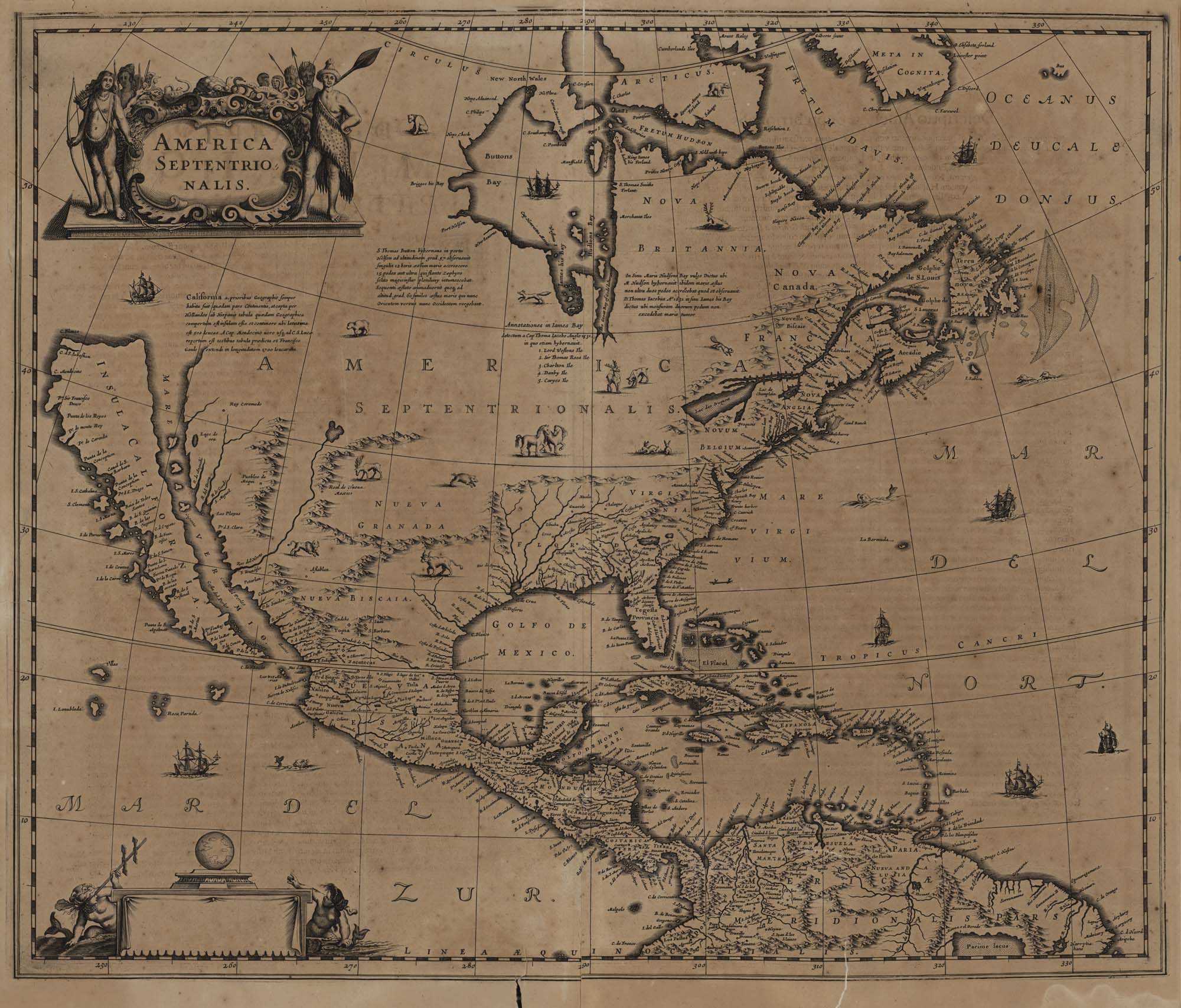
The Spanish Empire’s depiction of California—Alta and Baja—as a large island off the coast of North America is one of the bigger goofs in the history of mapmaking.
Yet, in some ways, it is an island. Cleaved off by the Mojave and the Sierra Nevada, the state’s native plants and animals constitute their own “floristic province.” During and after statehood, in the two decades between the Gold Rush and the completion of the transcontinental railroad, Americans arriving in San Francisco by ship found themselves back in their home country but likely greeted it almost as a new land. For centuries, maps had depicted California as a place entirely surrounded by water. Its name is even derived from Califia, a fictional queen who ruled over an all-female island society.
“Mapping a Changing California: Selections from the Seventeenth to the Twentieth Century,” on view from Aug. 25 - March 11, 2023 at the California Historical Society, shows how the history of cartography is intertwined with the formation of California as a sub-nation of almost 40 million inhabitants. Maps, in short, didn’t just lay out this topologically weird state. They all but created it. An exhibit about surveying the land, laying claim to it and, ultimately marketing it, the show includes everything from geographically dubious illustrations from Junipero Serra’s era to maps of ghost towns to mid-’60s guides to Disneyland attractions. The Gulf of California might not extend to the Oregon border, but this fake island has a lot going for it—with the acknowledgment that the discipline of cartography grew out of imperialism.
"California history doesn’t start with its first map. It started long before that," said guest curator Paige Laduzinsky. "But cartography is a very colonial thing. The maps that you see reinforce the idea of a settled place to lay claim to and explode in population."
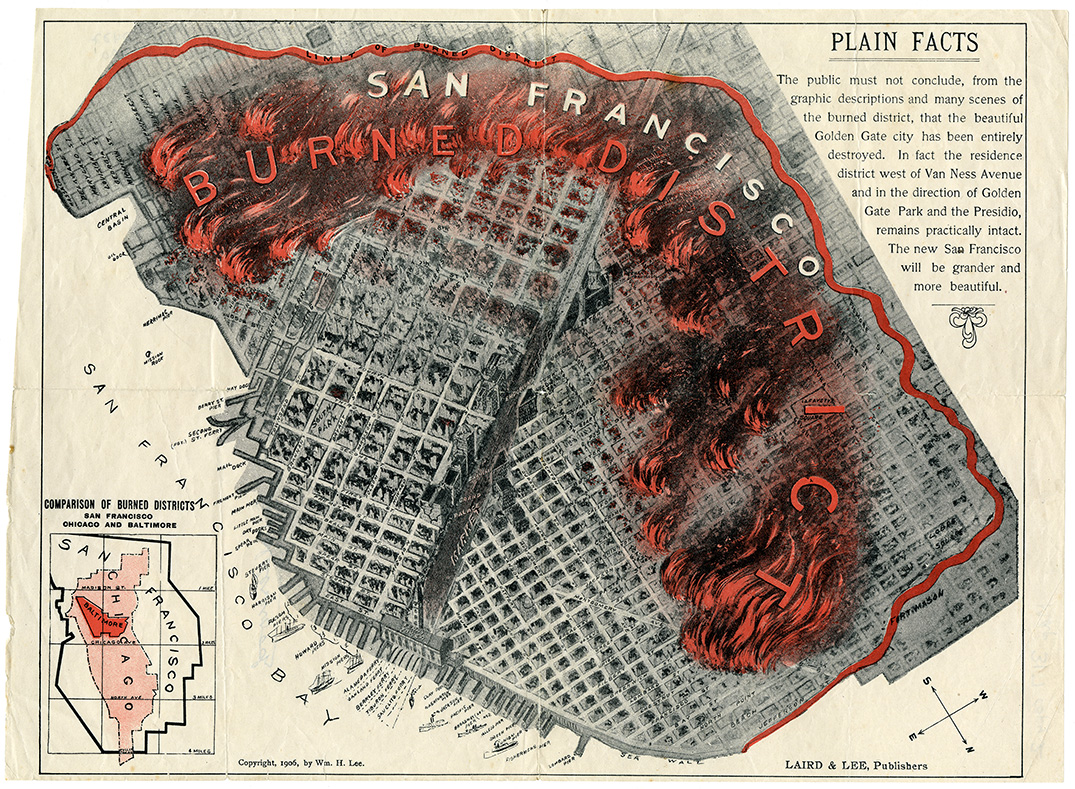
Still, for fans of cool maps, there’s a ton here. A vivid, almost lurid depiction of post-1906 San Francisco shows which parts of town burned after the earthquake and which survived. It’s clearly not meant to be useful for getting around town; north is oriented toward the lower right, around “four o’clock.” Look closer and you’ll see that it represents a kind of desperate, we’re-not-dead-yet boosterism, with an small inset map overlaying San Francisco and Chicago to highlight the latter’s far-larger burn zone from its own destructive fire 35 years earlier.
Much of the history is even more somber, starting with the European conquests that butchered many of California’s pre-contact population of 300,000. Almost as ghoulish is a 1940s state map showing concentrations of Japanese Americans for the purposes of efficiently rounding them up into internment camps like Manzanar and Tule Lake, but also Tanforan and even San Francisco’s own Sharp Park. (It’s paired with a heartbreaking letter from Fred Korematsu, the resister who fought against forced relocation, ultimately losing before the Supreme Court.) While undeniably a racist overreaction to Pearl Harbor, internment has also come to be seen as a land grab, a pretext for booting successful Japanese American farmers off their highly productive farms.
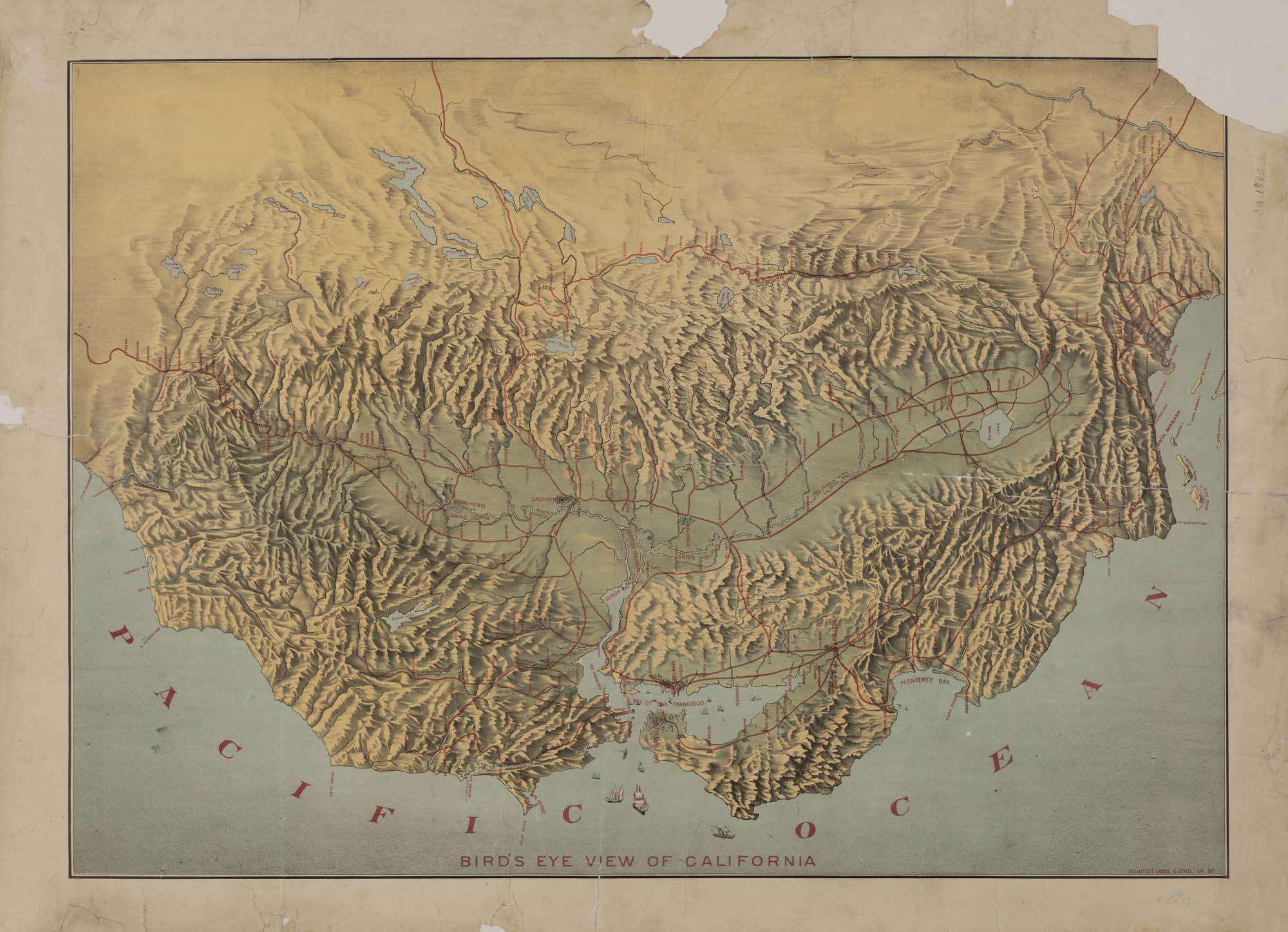
Even a cursory glance reveals just how much humans have altered the terrain, from lost lakes to now-abandoned boomtowns like the gold- and silver-mining outpost of Bodie.
"Doing the research for this exhibition, we were able to unearth some maps of places that are no longer here in California," Laduzinsky said. "We have this map of Kennett, a copper-mining town that was completely submerged in the construction of Shasta Dam, and of Tulare Lake. It was the largest body of freshwater west of the Mississippi, but it dried up due to mass agriculture in the Central Valley. It literally no longer exists."
Los Angeles’ growth, from a collection of ranchos to a megalopolis kept lush by stolen water, is also documented here. So is the grotesque practice of redlining, and promotional material enticing tourists to visit “Yo-Hamite” Valley. You can see how, as early as 1869, the future site of Golden Gate Park was listed on some San Francisco maps as “Park Reservation” (and, for some reason, written upside down). You will also find vintage maps to the stars. Cecil B. DeMille lived on DeMille Drive.
Even more fascinating is the calculated use of maps in the period after the Gold Rush, when apostles of growth and expansion turned to real estate as a way to keep the spigot of new arrivals open and enrich themselves further. In order to sell tracts to buyers, sight unseen, they had to commission surveyors and repackage it as attractively as possibly, with gorgeous lithographs and engravings portraying California as a well-surveyed paradise of limitless bounty. John C. Frémont, possibly the most openly genocidal figure in state history, was instrumental in this process, essentially massacring the rightful inhabitants to the land before helping market it to newcomers.
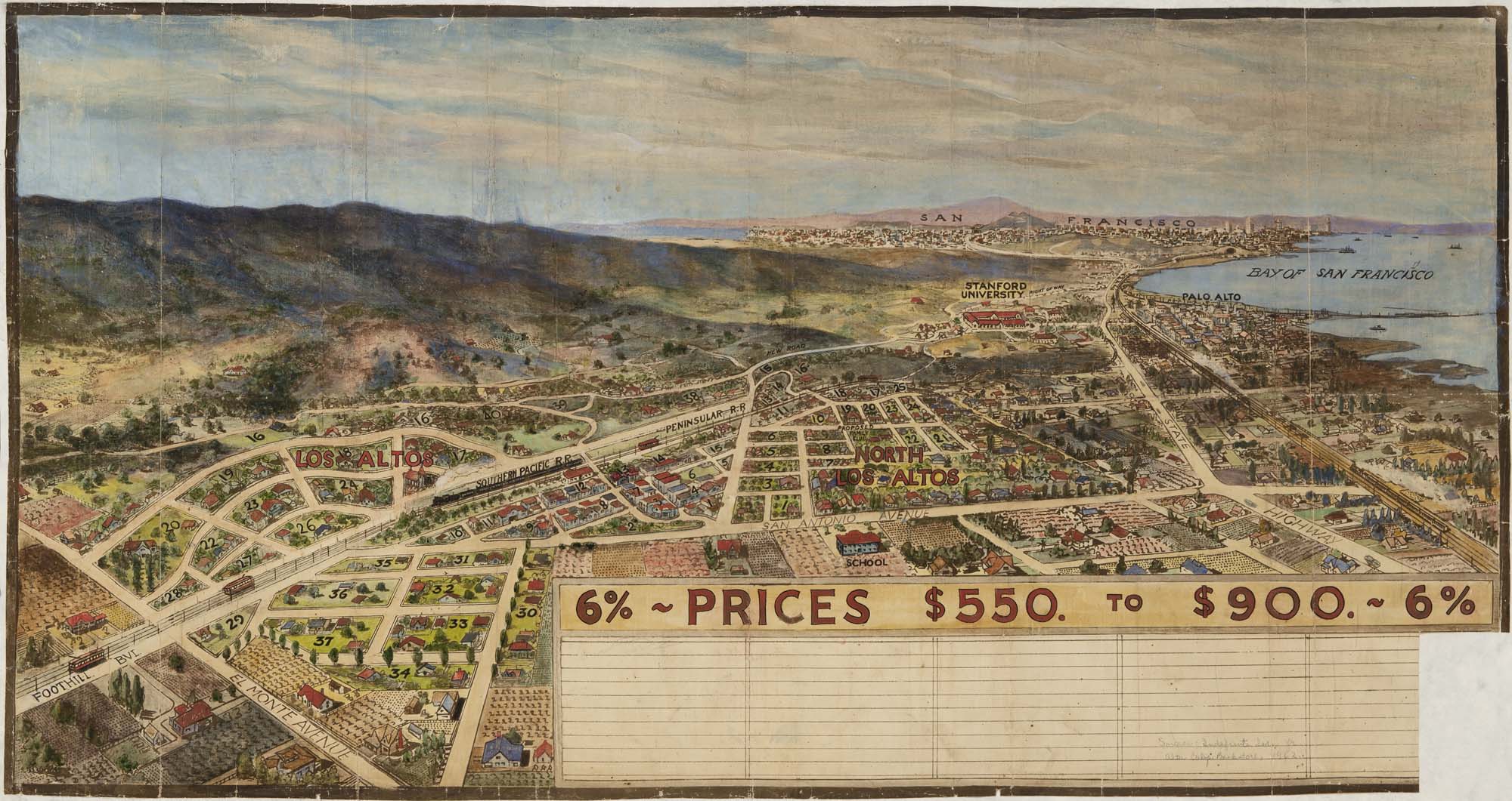
Consequently, some maps aren’t even intended to convey geographical accuracy, opting for shrewd distortions instead. One shows Los Altos’ proximity to the railroad and to San Francisco Bay, the better to lure settlers down the Peninsula to lots going for $550 each—considerably less than you’d probably pay per square foot today. California was never an island ruled by an Amazonian queen, but for hundreds of years it has looked enchanted enough.
The California Historical Society, 678 Mission St., San Francisco
Through March 11, 2023 | Free - $10