The new electoral map that comes every decade is starting to fall into place in San Francisco, with the California Redistricting Commission releasing new draft maps for state Assembly districts last week while a local election task force bears down on new Board of Supervisors’ districts.
The new Assembly map reverts from an earlier version that drew criticism for diminishing voices of color, and now consolidates the city’s southernmost neighborhoods, including Bayview and Hunters Point, into District 17.
David Campos, a candidate in the District 17 special election that will take place next year based on existing electoral lines, applauded the commission for listening to complaints from the community.
“The new draft strikes the right balance in addressing the many issues of equitable representation raised by the communities of color and the LGBTQ Community, whose voting power would have been significantly diminished by the prior map,” Campos said in a statement to the SF Standard.
The new map, which the commission will finalize no later than Dec. 23, pulls additional northern neighborhoods into District 19, currently represented by Phil Ting.
Longtime Bay Area political consultant Jim Ross said that while the updated draft is more similar to how the districts currently stand, its slight variations would combine the voting power of San Francisco’s most affluent neighborhoods — the Marina, Pacific Heights, Twin Peaks, Cow Hollow and Jordan Park.
“Whoever ends up representing [District 19] now represents some of the wealthiest people in the world,” Ross said. “That neighborhood has always been a little bit more split … The question I think in this map is, does it skew AD-19 to the Northern part of its district?”
Ross said that because the Southern part of the city is more dynamic in population growth, AD–17 may end up representing a larger portion of the city before the next redistricting.
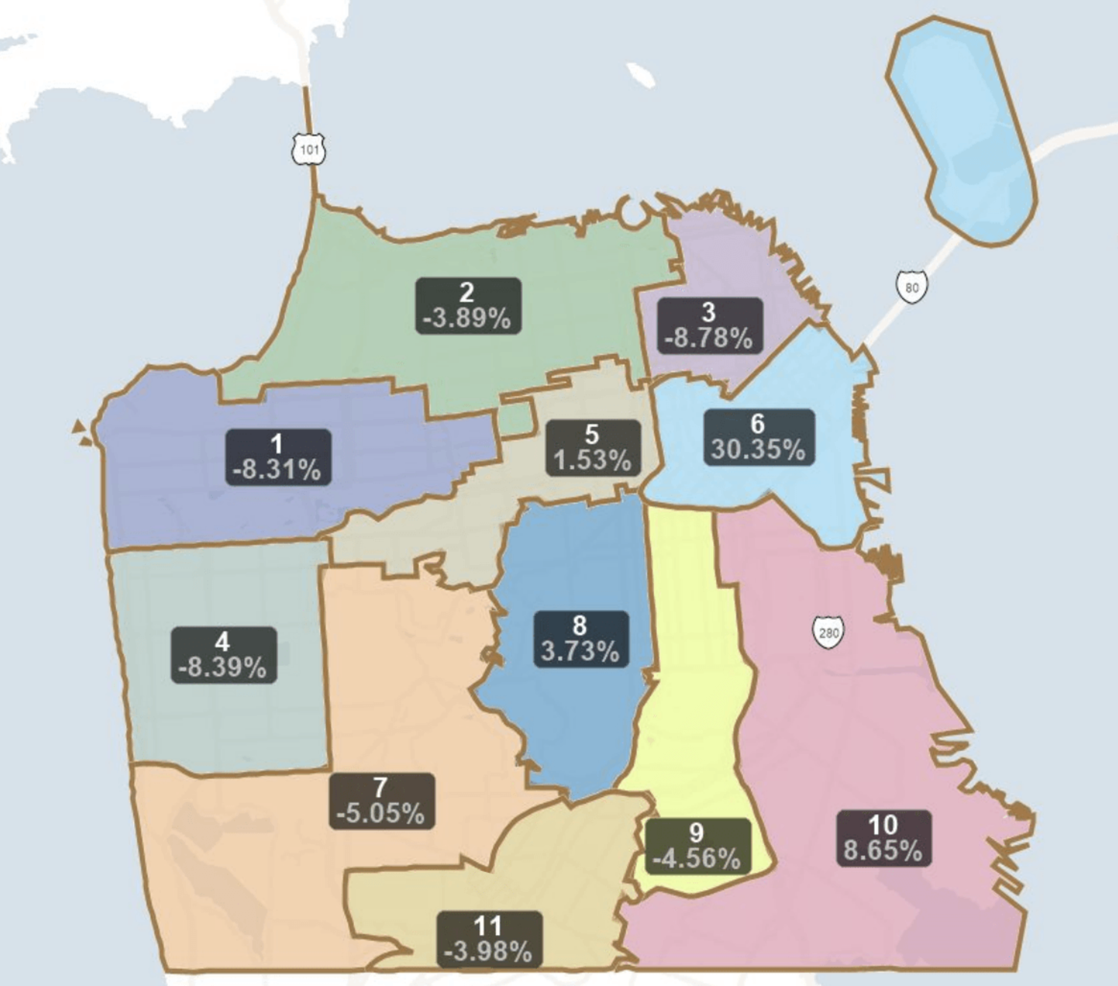
Meanwhile, a local elections task force, assigned to redraw Board of Supervisor district lines based on neighborhood population changes, will convene three times this week to address overpopulation in District 6.
The 2020 census determined that the district currently has 30.35% more people than any single district can contain for voting power to be distributed equally. District 6, which includes the Tenderloin, Civic Center and parts of SoMa, currently has over 17,000 more residents than District 10, which includes the Bayview, Hunters Point and the Dogpatch, and is the next most populated district.
The mayor, the Board of Supervisors and the Elections Commission appointed the nine-person redistricting task force to have the final say on the new district boundaries.
The task force will hold hearings (opens in new tab) and consider public comment until mid-April, when it will make final decisions. According to the task force’s information page (opens in new tab), the maximum variation it can allow is 3,561 extra people in any particular district if it’s necessary to “prevent dividing or diluting the voting power of minorities.”
