California is beginning 2024 with a below-normal mountain snowpack a year after it had one of its best starts in decades, and officials said Tuesday that the weather whiplash has made the outcome of this winter uncertain.
The water content of the statewide snowpack was 25% of the average to date, said Sean de Guzman, a water supply forecasting official with the California Department of Water Resources.
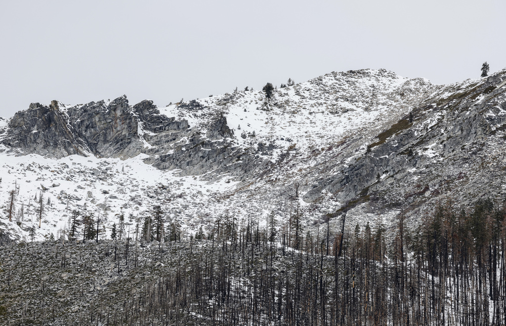
The snowpack functions as a huge frozen reservoir, providing about 30% of the water used annually in California as it melts and runs off into streams and rivers in the spring.
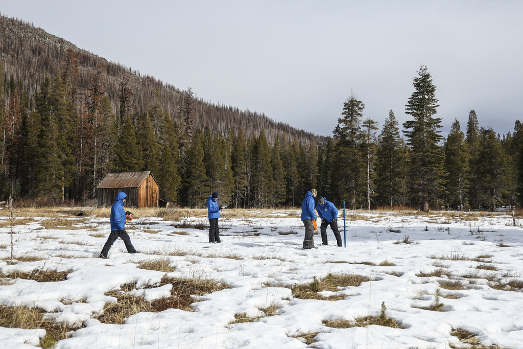
De Guzman conducted the first in a seasonal series of manual measurements on a snow course in the Sierra Nevada at Phillips Station, south of Lake Tahoe. The department also collects measurements with electronic instruments at more than 260 other sites.
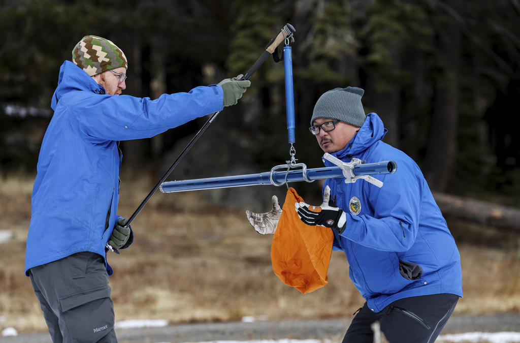
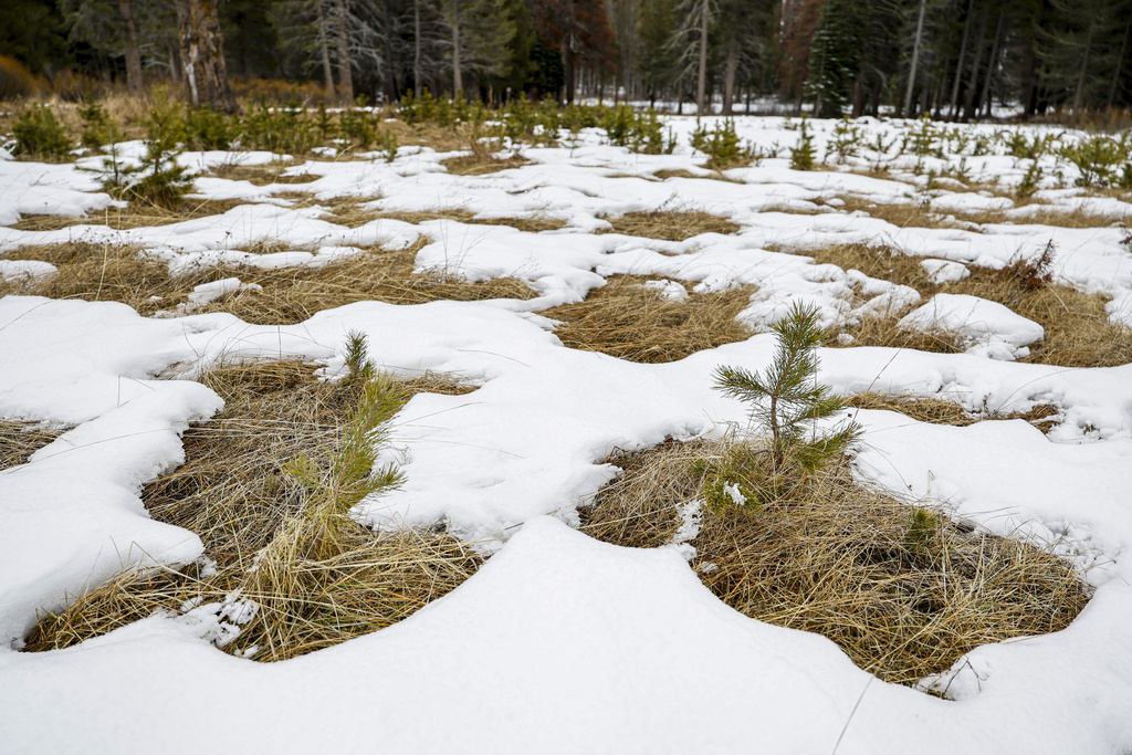
De Guzman and his crew methodically worked across a field with minimal snow and a checkerboard of bare spots, measuring and weighing samples.
A year ago, there were nearly 5 feet of snow at the location and the statewide snowpack was at 177% of average, he said in a webcast.
This time at Phillips Station, he recorded a snow depth of 7.5 inches and a snow-water content of 3 inches, translating to 30% of the average to date and 12% of the average on April 1, when the Sierra snowpack is typically at its peak.
“Today’s result shows that it’s really still too early to determine what kind of year we’ll have in terms of wet or dry,” de Guzman said, adding that many things can happen with storm systems between January and April.
Still, he noted, the state’s reservoir storage is at 116% of average, thanks in part to last year’s wet winter, which pulled the state out of a yearslong drought.
In addition, there’s currently a strong El Niño, a natural and occasional warming of part of the Pacific Ocean that can lead to more precipitation than usual in California, but doesn’t always come through.
“Right now, the Climate Prediction Center’s seasonal outlook for January, February, March is still showing an increased chance of above-normal precipitation and snow,” de Guzman said.
A year ago, the early January snowpack was already exceptional amid a barrage of atmospheric river storms that stood in stark contrast to three preceding years of drought. By April 2023, the snowpack was 237% of average to date.
The storms caused deadly and damaging flooding and crushed buildings with towering loads of snow, but when the state’s Oct. 1-Sept. 30 “water year” ended, enough rain and snow had fallen to fill the state’s reservoirs to 128% of their historical average.
Up to 2 Feet of Snow May Fall in Sierra This Week
The National Weather Service issued a winter weather advisory for the Lake Tahoe area from 7 p.m. Tuesday to 1 a.m. Thursday.
On Tuesday evening, snow accumulations of 5 to 11 inches were expected above 7,000 feet. More snow was expected Wednesday, and again on Saturday.
Wind gusts as high as 80 mph were forecast along the Sierra crest and up to 45 mph in the basin.
Even more snow was expected in Western Plumas County, including the cities of Chester, Quincy and Blue Canyon. Total snow accumulations of up to 19 inches were expected above 4,000 feet, with up to 24 inches over the highest peaks, and winds gusting as high as 45 mph.
The snow was expected to be heaviest from 9 p.m. Tuesday through 4 a.m. Wednesday.
“Travel could be very difficult to impossible with travel delays, chain controls, snow-covered roads and reduced visibility at times,” the weather service said.