An incoming atmospheric river this week could cause dangerous conditions due to an increased risk for mudslides and fallen trees, meteorologists warn.
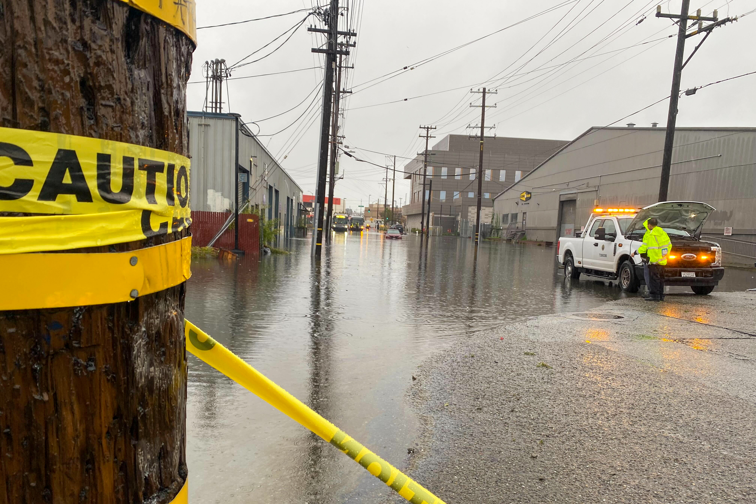
The storm, which could begin as soon as Tuesday evening, may be even worse than the deluge the Bay Area experienced on New Year’s Eve that flooded streets and caused mudslides in some parts of San Francisco and was the city's second rainiest day since 1849.
“Just about everywhere will be under the gun for heavy rain,” said Rick Canepa, a meteorologist with the National Weather Service (NWS). “The storm door is wide open for the next week or two.”
Early Tuesday morning, NWS tweeted that the "strong storm system" coming to the Bay Area and Central Coast would "increase the threat for widespread flooding and wind damage."
There is a flood and high wind watch for an area spanning much of the Bay Area and beyond including San Francisco, the East Bay hills, San Jose and the Santa Cruz Mountains. Canepa believes those will be escalated to advisories closer to Wednesday.
“To put it simply, this will likely be one of the most impactful systems on a widespread scale that this meteorologist has seen in a long while,” a National Weather Service forecast said, with impacts including "the likely loss of human life.”
.@NWSBayArea not mincing their words about our next atmospheric river. pic.twitter.com/zXKgWDyKir
— Drew Tuma (@DrewTumaABC7) January 2, 2023
ABC7 meteorologist Lisa Argen advised those living near hillsides, creeks and slews to consider evacuating given the higher risk of mudslides due to high winds and heavy rain this week.
"Considering what happened on [Dec. 31], it's going to be worse," Argen said.
The increased mudslide risk this week is because the ground is already saturated with water and will be unable to soak up the rain. The heavy wind in combination with water-logged soil could make it especially likely for trees to fall and for landslides, according to Argen.
An NWS forecast said the San Francisco Bay Area will experience light rainfall late Monday afternoon and evening before an atmospheric river arrives late Tuesday and into early Wednesday, along with heavy winds. Rain will be heaviest late Wednesday morning through early Thursday.
“Bottom line for this week is that for the Jan. 4-5 storm, expect similar impacts or worse compared to what happened on Dec. 31,” the NWS forecast said.
PG&E is still restoring power to customers who lost power due to the Dec. 31 storm; representatives said in an email that there are 258 households without power in San Francisco and 20,000 households throughout Northern and Central California. PG&E is looping in crews from Southern California to aid with restoring power.
“Our focus today is on assessing damage and making needed repairs to restore power to the remaining customers affected by the storm,” said Megan McFarland, a PG&E spokesperson.
Victor Lim, a manager at the city's Department of Emergency Management, said that areas in the city that were not flooded during the Dec. 31 rainstorm are unlikely to be flooded during this week's storm either. The city will also focus on unclogging street drain to prevent roadway flooding.
"We understand there are low-lying areas in San Francisco that are prone to flooding and flooded during the storm this weekend. If you have not experienced flooding in the past, the risk of experiencing flooding now is low," Lim said during a phone interview.
Lim advised that in the case of roadway flooding people should stay out of deep puddles due to the risk of sewage backflow and that drivers should avoid driving through flooded areas, which could cause cars to hydroplane and crash.
To receive text alerts with updates about the incoming storm from the city, text your zip code to 888-777.
This story is developing and will be updated.