A 4.1 magnitude earthquake startled dogs near Bay Point last June. Then a pair of 4.3s toppled Santa Rosa picture frames in September. The largest quake of them all struck in October when a 5.1 magnitude shake east of San Jose jolted residents across the region.
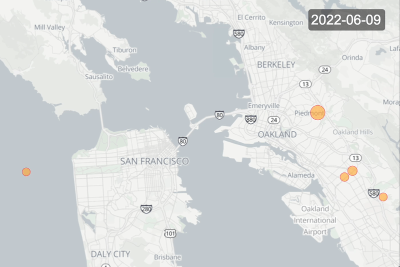
These were the four most powerful earthquakes that shook the Bay Area in the past year—from April 2022 through March 2023—but they were far from the only ones. There were 941 earthquakes in the region during that time period, according to data from the U.S. Geological Survey (USGS). The vast majority—926 of them—registered less than a magnitude 3.0, leaving it likely that they went largely unnoticed.
Tuesday is the 117th anniversary of the Great 1906 San Francisco Earthquake. The magnitude 7.8 quake and subsequent fire decimated the city and went on to become one of the most scientifically significant shakes of all time. To mark the occasion, The Standard combed through USGS data to understand this past year in earthquakes and asked local seismologists the question on everyone’s mind: When might the “Big One” strike again?
Hundreds of earthquakes rumbling through the Bay Area in a year is totally normal, explained USGS Observational Earthquake Seismologist Annemarie Baltay.
“It’s basically the Earth telling us that it’s just doing its thing,” Baltay said.
The land and ocean on the Earth’s surface sit upon massive slabs of solid rock called tectonic plates. These plates lie on molten rock and each one moves, very slowly, at a different speed.
Two of the Earth’s major tectonic plates—the North American and Pacific—meet underneath California. These plates move past each other about 2 inches per year, and at the intersections, known as faults, the motion can produce sudden slips, which we feel as earthquakes.
The San Andreas Fault is the main point of much of the slippage between the two plates under California, earning it the titular role in a major motion picture. It’s also a close San Francisco neighbor, passing just south and west of the city.
Back in the 1800s, major quakes along the fault were more common, explained Stanford Professor Greg Beroza, an observational earthquake seismologist.
“There were times when there were damaging earthquakes in the Greater Bay Area about once a year,” he said. “It was a very different place back then seismically.”
Earthquakes are driven by accumulated, strained energy that is stored in the Earth’s crust when the interiors of the massive tectonic plates continue moving but the faults are locked. Eventually, that energy has to be liberated in the form of earthquakes, Beroza explained.
After a long period of significant earthquakes in the 1800s, there was a massive energy liberation when a 300-mile rupture of the San Andreas Fault took place between San Juan Bautista, a small town southeast of Santa Cruz, to Cape Mendocino, which is 40 miles south of Eureka. The Great 1906 San Francisco Earthquake was the result. It caused violent shaking that lasted up to a full minute. Though it predated modern measuring techniques, scientists now believe that the 1906 quake was likely a magnitude 7.9.
Researchers have observed that once the aftershocks from a major quake of that magnitude die down, it can usher in an era of relative dormancy.
The thinking goes that the 1906 quake was so big that it relieved the stress on the San Andreas Fault, ushering in a century of fewer damaging quakes, Beroza said.
But that doesn’t mean that the Bay Area can let its guard down. In fact, in 2008, scientists predicted that there was a 68% chance that a 7.0 magnitude would hit the region sometime in the coming 30 years. That would be larger than the 1989 Loma Prieta quake—a 6.9—which collapsed the freeway in Oakland.
That’s because instead of the San Andreas Fault, experts expect that the next damaging earthquake to hit the Bay Area will likely come from one of its less famous neighbors.
Based on the historical record, we’re overdue for a significant earthquake on the Hayward Fault, which runs below the East Bay hills, Baltay explained.
The fault is “among the most active and dangerous in the United States because it runs through a densely urbanized and interconnected region,” according to a 2018 USGS report.
There have been immense advances in construction practices since the 1906 earthquake. But no city can be impervious to the power of a devastating quake.
“Anytime you dump that amount of kinetic energy into a heavily populated area then things will break and bad things will happen,” Beroza said.
If a 7.0 earthquake hit underneath Oakland along the Hayward Fault—a real possibility—the shaking could kill 800 people, injure 18,000 more, set off fires across the region and cause over $82 billion in building damages, researchers estimated.
Baltay urges Bay Area residents to prepare for the next big earthquake, including making a family plan for where to meet and what to grab from the house in case of emergency. It’s a good idea to store three days of food and water too, she said.
“We haven’t really had a very large Bay Area earthquake in a long time,” Baltay said. “We don’t want people to forget.”
Correction: An earlier version of this story incorrectly labeled recent earthquake magnitudes as measured on the Richter scale. USGS currently reports magnitudes using the Moment Magnitude scale.