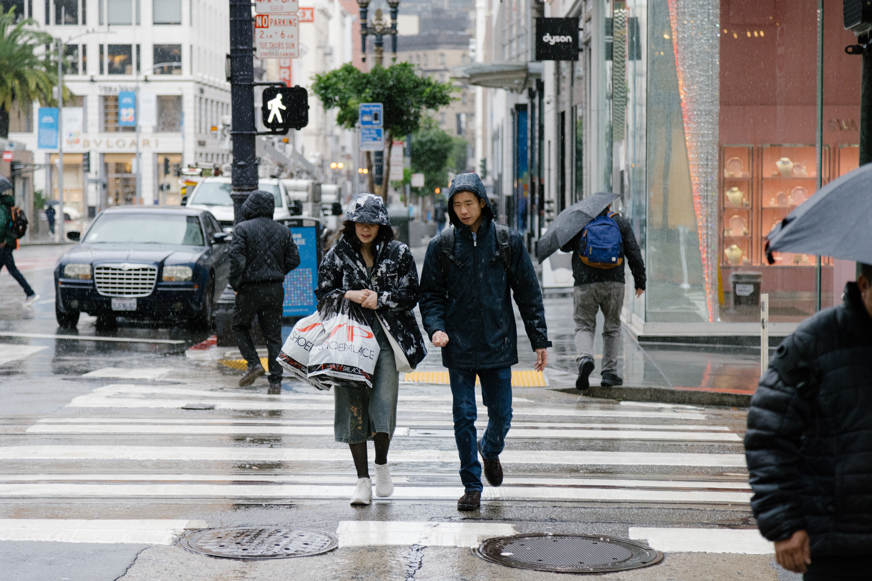
San Francisco Department of Public Works staff were on standby for mudslides, downed trees and flooding Wednesday as heavy rains pounded the Bay Area. Sandbags for residents and businesses were doled out for free.
After the city was hit hard during last winter’s series of atmospheric river storms, Public Works spokesperson Rachel Gordon said the department’s staff has honed its wet-weather responses in coordination with the city’s Department of Emergency Management.
Gordon told The Standard that the city’s distribution site—its operations yard at Marin and Kansas streets—would be open from 8 a.m. to 2 p.m. and would offer up to 10 sandbags per address with “plenty on hand.”
According to the department, anyone picking up sandbags must show proof of address and be able to load bags into their own vehicles, with limited exceptions.
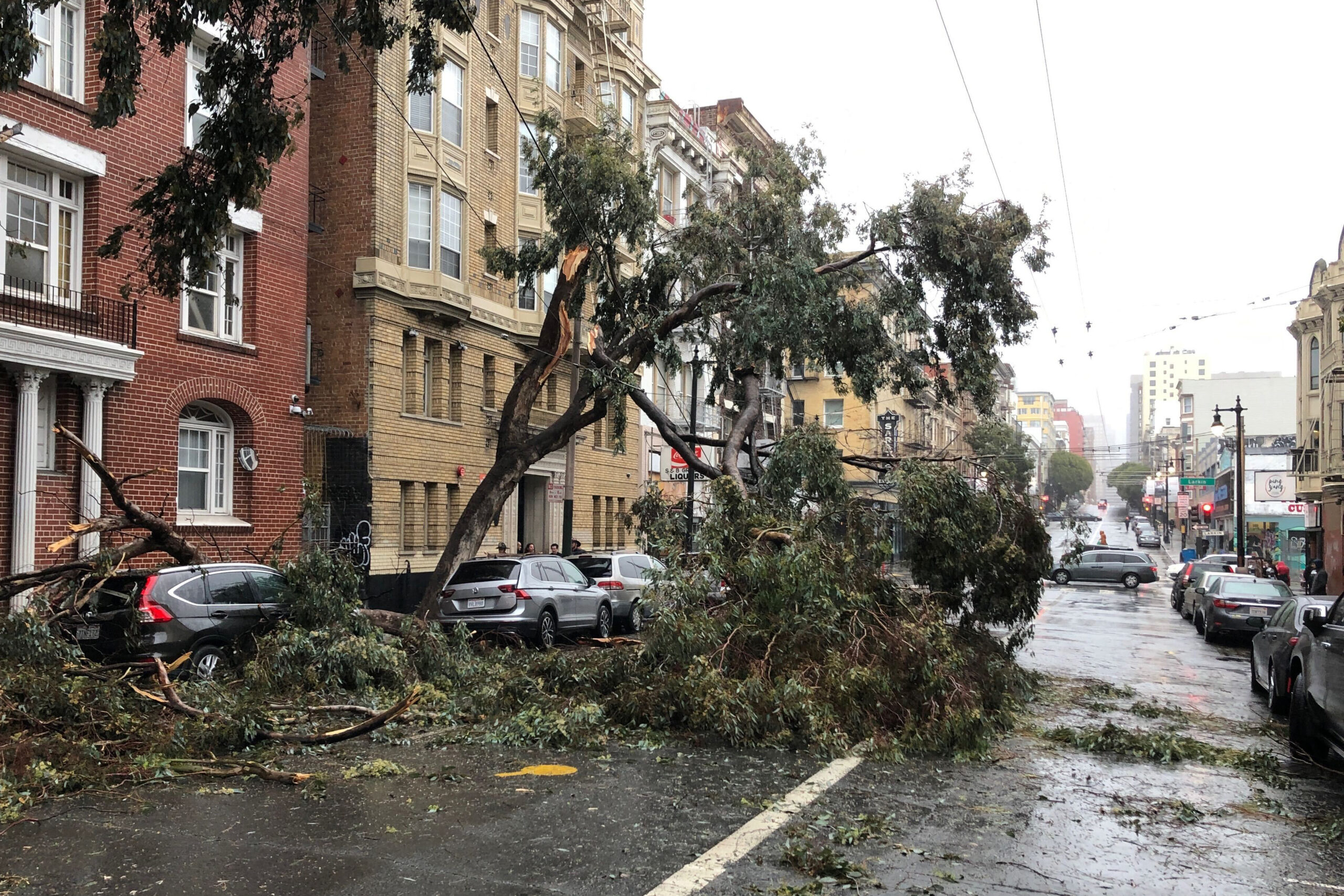
Public Works engineers will watch slide-prone hillsides, posting barricades to block off hazardous areas, while tree crews will be on call to handle fallen trees and limbs.
During the day, street cleaners cleared litter and leaves from vulnerable storm drains, while road-repair crews were ready for calls as they came in.
To report downed trees, flooded intersections and non-emergency storm issues, anyone may call 311. If power lines are down or fallen trees put people or property at risk, then call 911.
Wednesday’s storm system arrived in San Francisco shortly before 10 a.m., accompanied by strong winds with gusts topping 40 miles per hour, including readings atop some Bay Area mountains and hills topping 50 mph around 8:30 a.m., according to the National Weather Service.
By 2:20 p.m., the North Bay had logged 0.25 to 0.5 inches of rain while the mountains saw up to 1.7 inches, the agency said. Less than 0.25 inches had fallen from the Golden Gate to Santa Cruz with the heaviest rain yet to come.
On Wednesday evening, the San Francisco Municipal Transportation Agency said it was temporarily stopping cable car service as a safety precaution until the weather improved.
NWS meteorologist Nicole Sarment told The Standard that peak periods of rain were due around 4 p.m., in time for the afternoon rush-hour commute, persisting until around 8 p.m., with totals through early Friday reaching just under 2 inches alongside temperatures in the mid-50s and southerly winds gradually swinging southwest.
Downtown San Francisco had recorded nearly 1.5 inches of rain by 9:30 p.m. Wednesday, while the Sonoma County Airport saw 2.03 inches and Mount Tam got 2.61 inches, according to the weather service.
An added round of showers early Thursday should greet commuters hitting regional roadways, with occasional light rains continuing through Friday and Saturday. A second storm, nearly similar in size to this one, is expected to arrive Sunday afternoon through Monday, bringing more than 2 inches of rain.