A cold front is expected to bring strong winds, steady rain, and thunder to the Bay Area through Friday. But what’s unusual about the weather is the chance to glimpse the aurora borealis much farther south than usual.
For example, Floridians (opens in new tab) got to see the light show this week. But in the Bay Area, the view may be obscured by gray clouds.
National Weather Service meteorologist Brian Garcia described the confluence of conditions as a significant weather event for mid-November.
When will it rain?
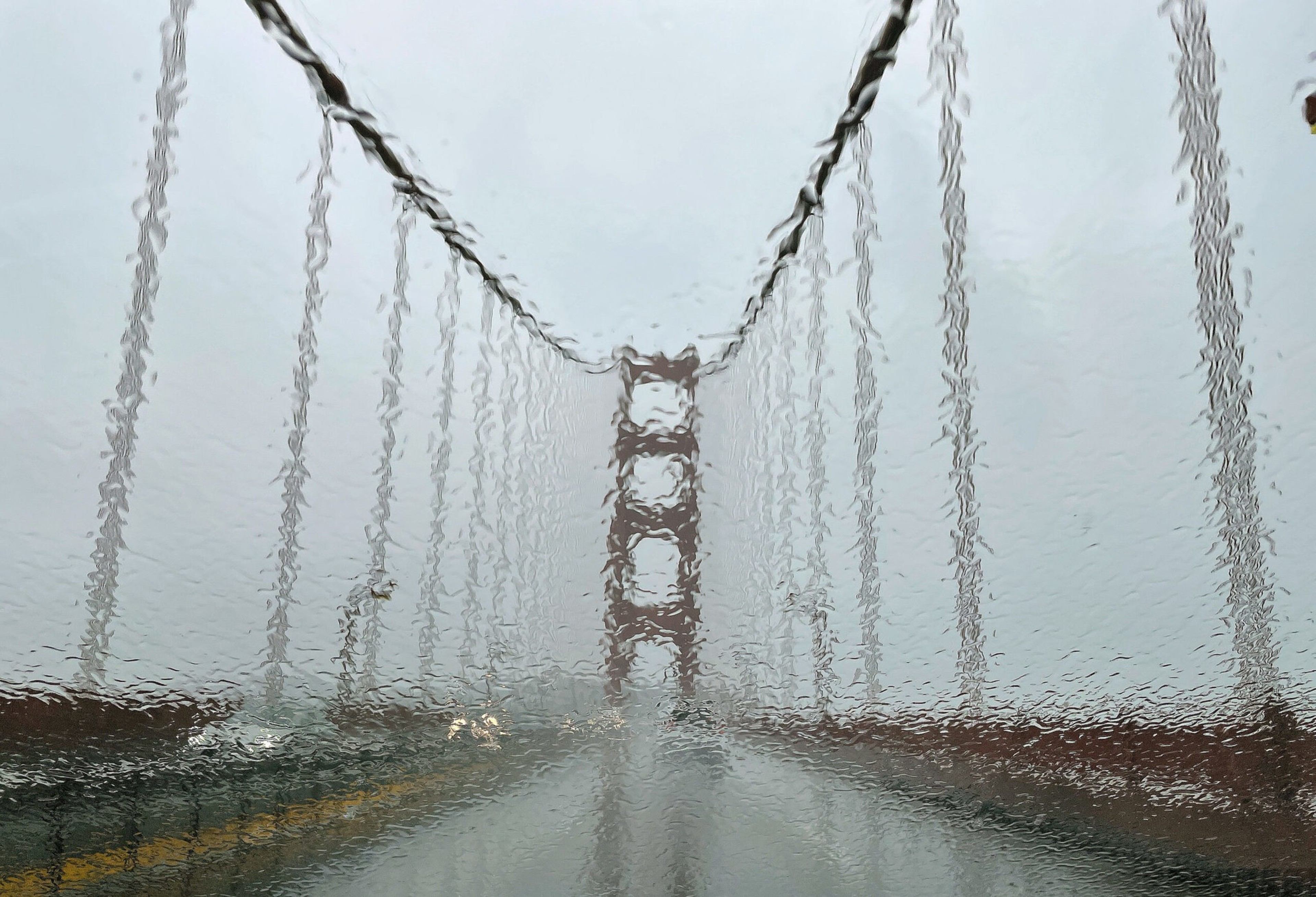
A few hundredths of an inch fell Wednesday morning in the North Bay. The heaviest rain will arrive by Wednesday afternoon and evening, with the core of the system expected Thursday around 3 to 5 a.m.
“People are going to be sitting in their cars tomorrow morning, getting ready to head off to work, and the rain’s going to be coming down pretty solid,” Garcia said Wednesday.
The rain is expected to ease up later Thursday, with scattered showers through Friday.
How likely is thunder?
There’s a low likelihood of thunder.

Subscribe to The Daily
Because “I saw a TikTok” doesn’t always cut it. Dozens of stories, daily.
“Right now we’re looking at about a 20% chance, and it doesn’t necessarily cover the entire Bay Area as it rolls through,” Garcia said.
Any thunderstorms that develop will likely occur late in the morning Thursday.
Why are coastal areas under a high-wind warning?
The NWS has issued a high-wind warning for the coast from Santa Cruz and north through San Francisco, Sonoma, and Marin counties. The warning extends to coastal waters, which may see hurricane-force winds.
“The front is effectively unabated by any sort of land mass to try to break it up,” Garcia said.
That means the storm will strike the coast with full force.
How strong will the winds be?
Coastal areas and the Marin hills could see winds at 60 to 70 mph. San Francisco, particularly Ocean Beach and the Presidio, could see gusts up to 50 mph. Wind advisories are in effect for the rest of the Bay Area and central coast through 10 a.m. Thursday.
What should residents prepare for?
Falling branches are a risk — especially at this time of year, when trees are leafy.
“Those leaves can act as nice little sails to catch a little bit of wind and cause more branches to fall than we might normally see,” Garcia warned.
Downed branches could cause power outages, while leaves and debris could clog storm drains and flood streets.
Garcia suggests securing all outdoor items prone to toppling.
“We had 81 degrees two days ago in Santa Cruz,” he said. “People may still have their patio furniture and lawn chairs out. Secure those things; put away things that could blow into the house and cause property damage or damage to life.”
Garcia advised people to work from home Thursday if possible. “It’s not going to be a fun day to be out on the road,” he said.
For those who must commute, Garcia stressed the importance of vehicle maintenance. “A lot of us haven’t thought about our windshield wipers since last winter, and a lot of us haven’t thought about our car tires since last winter,” he said. “There’s going to be a lot of water on the roadways. It’s going to be a very challenging commute, and I anticipate several accidents tomorrow.”
What’s the weekend forecast?
After the storm passes, the weather will take a turn for the brisk. Expect daytime highs in the upper 50s and low 60s and overnight lows in the mid-40s into early next week.
With occasional showers, shorter days, and lower sun angles, Garcia said, “it’s going to feel cool and chilly, especially with all the water on the ground.”
About that aurora borealis …
A coronal ejection from the sun’s surface Tuesday caused a bout of extreme geomagnetic weather that led to aurora borealis sightings across the globe, particularly from latitudes that rarely see the colorful curtains cascading across the skies.
The U.S. Space Weather Prediction Center (opens in new tab) said the lights may be visible again as soon as Thursday.
“I have gotten pictures from friends of mine from other parts of the country, and they’ve been stunning — from Kansas City to Boulder,” Garcia said.
Alas, the incoming storm may thwart the chance to see the phenomenon from the Bay Area.
What about flights out of SFO?
Shortly before 8 a.m. Wednesday, SFO reported 46 canceled flights and 26 delays. The delays, mainly on short West Coast flights, averaged 25 minutes.
SFO spokesperson Doug Yakel said strong winds “will likely cause us to have to use a different runway configuration from the norm, which is less efficient and has the potential to cause delays and cancellations separate from the government shutdown.”