As recently as Christmas, California looked as though it might enter a fourth year of extraordinary megadrought. Less than three months later, some parts of the state now have to manage excessive amounts of water. Lake Oroville, the Butte County reservoir that impounds the Feather River, may have experienced the most dramatic reversal of fortune. For instance, in August 2021, its hydroelectric power station had to shut down because the level of the lake was too low.
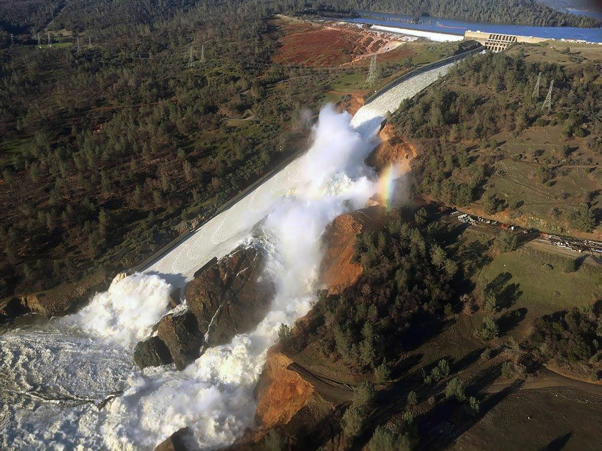
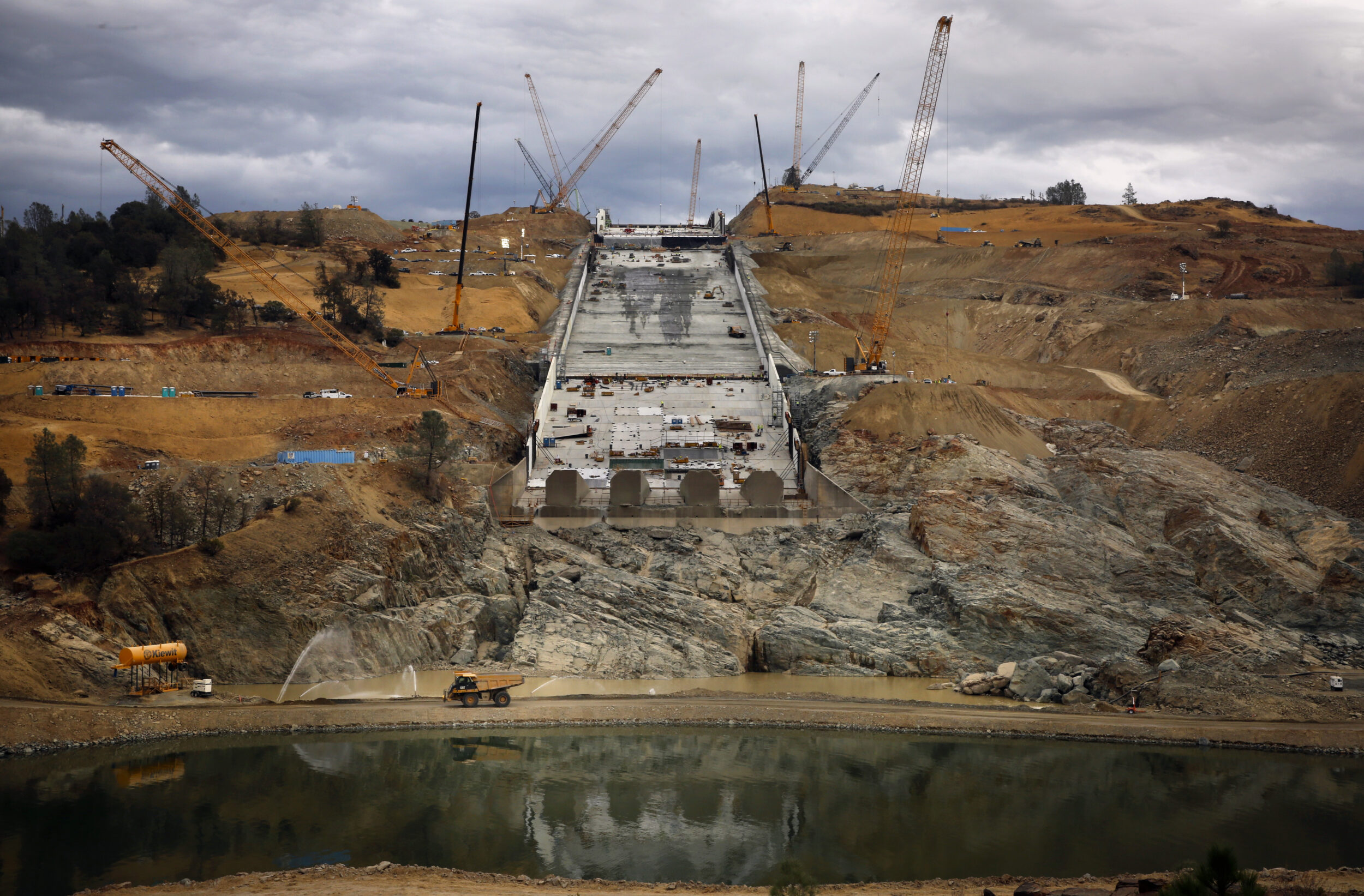
Lake Oroville is also the same reservoir whose spillway suffered a structural failure in February 2017, leading to the precautionary evacuation of 180,000 Californians from their homes.
The California Department of Water Resources held an information session on Thursday to discuss the activation of its Flood Operations Center ahead of this latest bout of atmospheric storms. Two are a near certainty over the next few days, and another two appear likely to form after that, delivering significant rainfall to California through the end of the month.
Unlike January’s intense weather, though, these are warmer systems. As they’re arriving later in the winter, they threaten to melt much of the season’s near-record snowpack across the Sierra, which means that runoff as well as rainfall will enter Lake Oroville, Folsom Lake and other reservoirs. A few of them will strategically release any excess water, some of which can then be captured and channeled underground to help recharge the state’s depleted aquifers.
“We know drought will return, and it’s these moments we have to capture to be resilient in the event of future dry conditions,” said Karla Nemeth, director of the California Department of Water Resources. “Water management is complicated. More so now, with swings from very wet to very dry—and we’re now back to wet.”
Michael Anderson, a state climatologist, called the expected rainfall totals “really amazing numbers.”
“It’s similar to January, but we’re starting from a very different point,” he added. “These six-day totals will lead to really significant runoff.”
Some of that runoff will enter Lake Oroville, which is formed by the 770-foot Oroville Dam, the tallest in California. On Friday, the lake’s managers will begin preemptively releasing water via its reconstructed spillway, which was quickly replaced after the 2017 near disaster and safely handled a release of water in April 2019. A subsequent investigation by a panel of independent experts later found the structure to be sound.
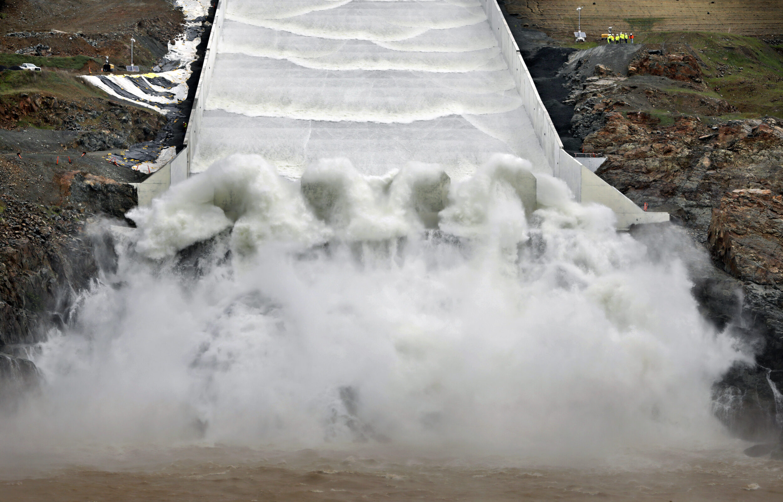
Ted Craddock, deputy director of the California State Water Project, said the spillway will drain the reservoir at 15,000 cubic feet per second, a rate that can be adjusted up or down as meteorological conditions change.
While officials emphasized that the state’s flood-control systems are functioning as they should, atmospheric rivers are dynamic systems and forecasts can change rapidly. One area of concern is the changing snow elevation, which could shift to 6,000 feet or higher, leading to snowmelt.
“Sometimes things come in stronger or slow down over areas, so rivers can rise very quickly,” Nemeth said. “It does have the potential to be a dangerous situation, particularly in areas that experienced flooding before.”