When hundreds of cyclists took over the lower deck of the Bay Bridge’s western span in early August, it was a guerrilla action that interrupted the flow of vehicular traffic for about half an hour. As a group ride, it surely gave everyone an illicit thrill. But as a protest, it was intended to highlight a missing piece of the Bay Area’s transportation network.
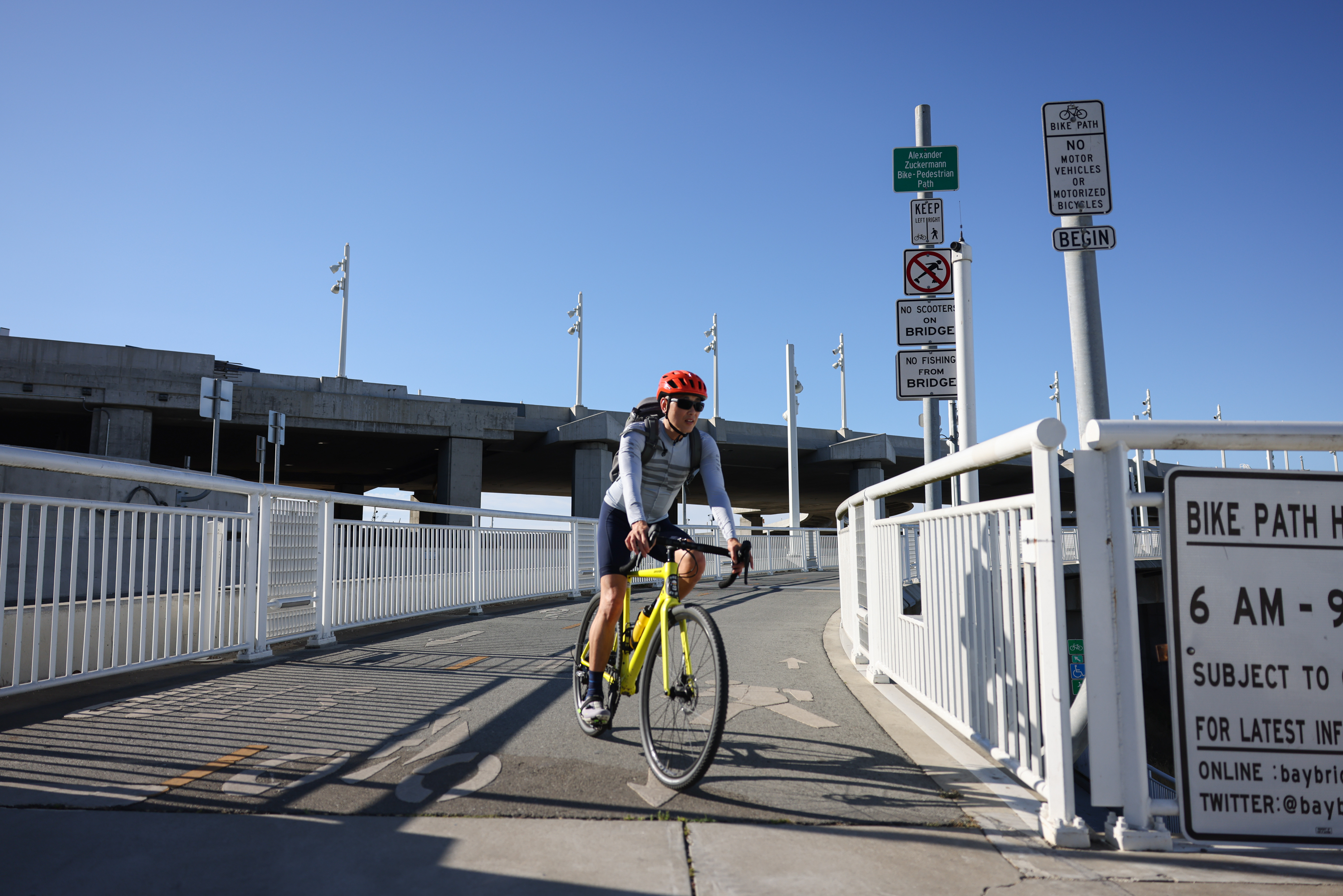
It’s possible to pedal or hoof it the three miles or so from Oakland to Yerba Buena Island, in the middle of the bay. But in order to get to San Francisco from there, you have to thumb a lift, take the semi-frequent 25-Treasure Island bus or ride on a beautiful but even-less-frequent ferry. Ten years after the Bay Bridge’s eastern span opened, why does the traffic-clogged region still lack a direct way to bike and walk across the bay?
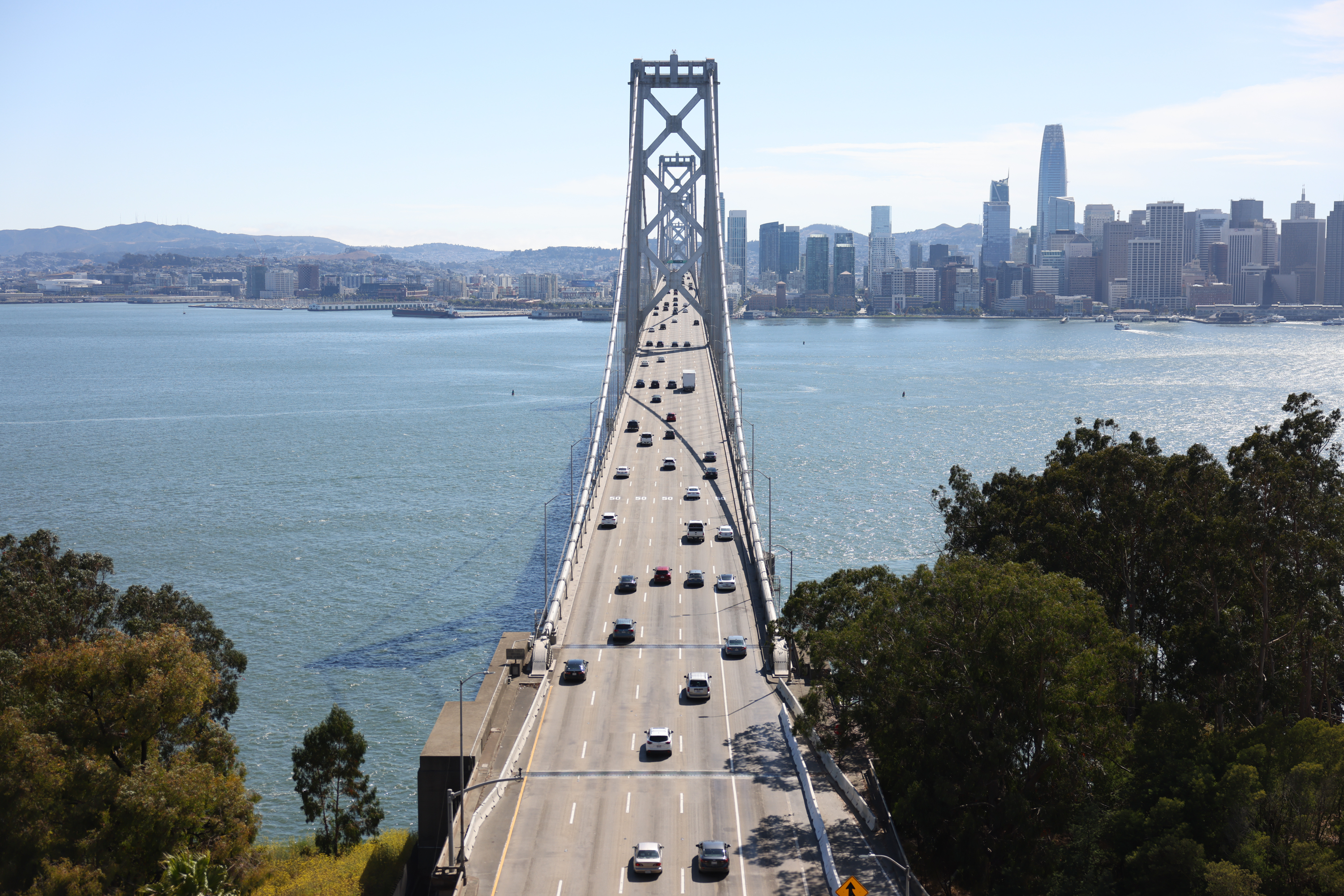
The answer to that question contains a financial component—unsurprisingly, it’s an expensive proposition—and an engineering component. Keep in mind that what we refer to as the “Bay Bridge” is actually a complex of two separate bridges connected by a tunnel.
beautiful day to ride the bay bridge pic.twitter.com/zqGLjZU0JZ
— Safe Street Rebel (@SafeStreetRebel) August 6, 2023
Safe Street Rebel, a militantly anti-car Twitter account that commented extensively on the Aug. 6 ride, responded candidly to The Standard’s inquiry: The eastern span included a bike path when it was rebuilt, but the western span only got a seismic upgrade.
“There are options: Pay $500 million for a new bike path hanging off the side or take a lane away from cars like they did on the Richmond Bridge,” the anonymous rebel said. “Both are politically difficult.”
Indeed, taking a lane away from cars can be an unpopular move, even in a region that bills itself as committed to transportation alternatives. The Metropolitan Transportation Commission, which oversees the Bay Bridge, has been committed to a bike lane along the western span—one that’s cantilevered over the north-facing side, where the better views are.
A 2.2-Mile Path Into the Sky
In planning documents, the “Bay Skyway” appears to be almost an inevitability, developing organically out of Treasure Island’s anticipated population boom and the rise of e-bikes and other forms of mobility. But its future seems clouded, as if a Magic 8 Ball returned only long-winded replies in bureaucratic jargon.
For one, there’s the cost estimate.
“They put it in the range of $300 million in 2016 dollars, and then you had your 20% contingency and inflation, so it could be a half-billion dollar project,” said John Goodwin, spokesperson for the commission. “Which is not to minimize the design challenges, because they are myriad.”
Apart from grafting a 2.2-mile path onto the existing bridge, there are less-grandiose concerns, from Americans with Disabilities Act compliance and emergency access to simple maintenance. At 220 feet above the shipping channel, salty air loves to corrode paint and metal alike.
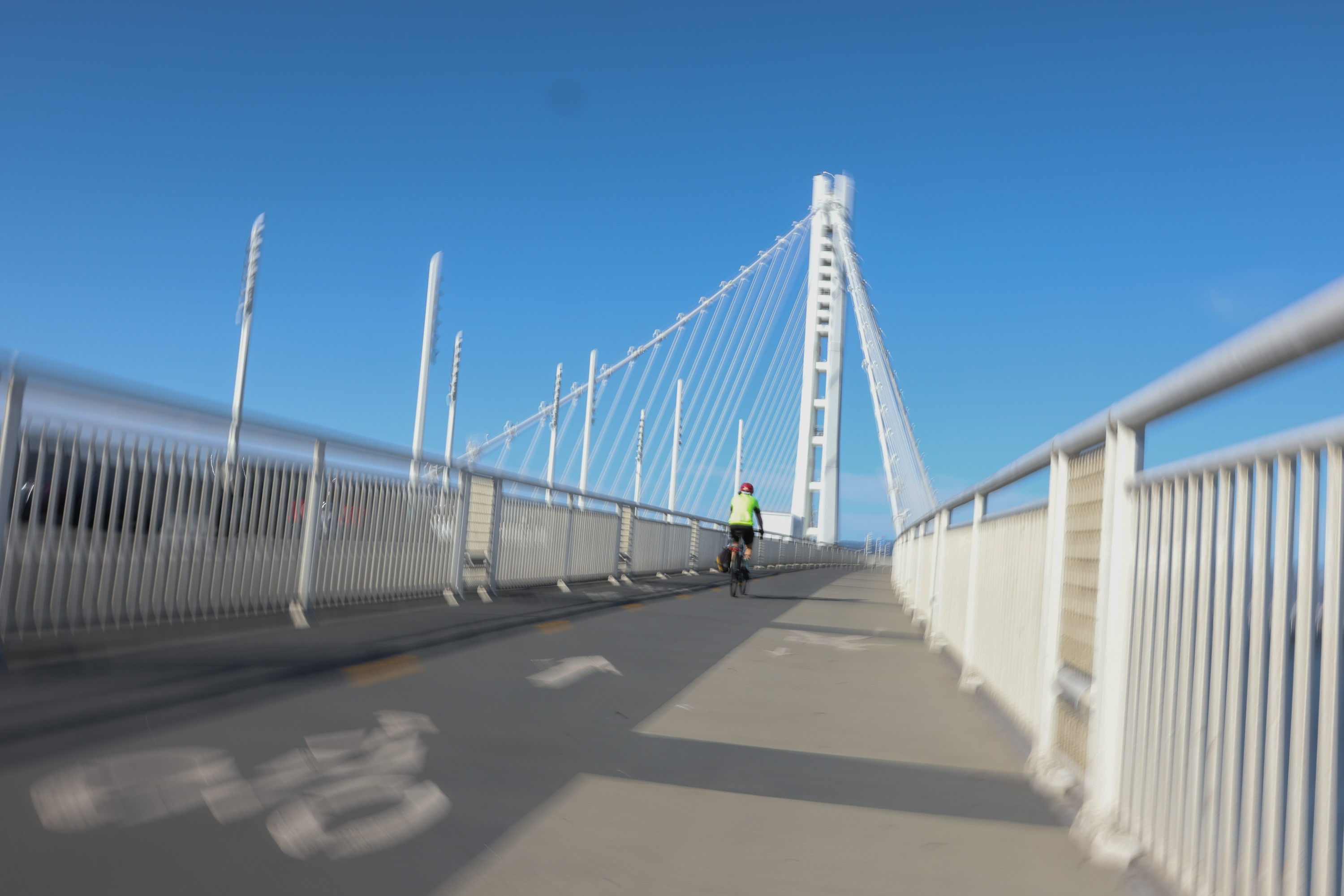
The other question is how to safely and cost-effectively get cyclists and pedestrians from the bridge deck to street level. On the eastern end, the roadbed touches down gracefully, with the bike path clearly signed and accessible near Emeryville Ikea. On the opposite side, you have Downtown San Francisco’s thicket of high-rises.
“Presumably, the path would follow the arc of the ramp that connects to the Transbay Transit Center,” Goodwin said. “There were other designs, with elevators and whatnot. All of them are feasible, but they’re not easy—and it’s a very windy location.”
Complexities aside, this project isn’t a planning pipe dream like, say, a BART line under Geary Boulevard. The next step, an environmental analysis, is expected to be complete by the end of next year, theoretically nudging state and local governments to start finding the money.
“Our most optimistic guess is that, if we can secure funding, the earliest possible opening date is 2030,” Goodwin said.
Infrastructure projects aren’t known for punctuality, but advocates are tactfully biding their time. Noting that the Bay Skyway design—referred to as “the People’s Path”—was unveiled in 2018, the San Francisco Bicycle Coalition encouraged policymakers to put words into action.
“The SF Bicycle Coalition urges the [Bay Area] Toll Authority and its partners to secure funding and political support to implement the ‘People’s Path’ design so we can realize the vision of connecting the East Bay, Treasure Island, and San Francisco for people who bike, walk and use other forms of active transportation,” the coalition said in a statement.
At present, cyclists can ride over most of the other bridges that span the region’s various bays—most notably the Golden Gate, but also the humbler Dumbarton and Benicia-Martinez bridges. Pedaling from Downtown Oakland to Downtown San Francisco via Marin is a 40-mile ride that takes more than three hours, far more than even the most hardcore, Lycra-clad rider wants to commute. Today’s tricycle riders may end up cutting the Bay Skyway’s ribbon.
It is, indeed, a challenge. But as Goodwin put it: “There’s already a bridge there.”
Clarification: Safe Street Rebel said it did not help organize the Aug. 6 ride.