This winter has been atrocious—like, really bad.
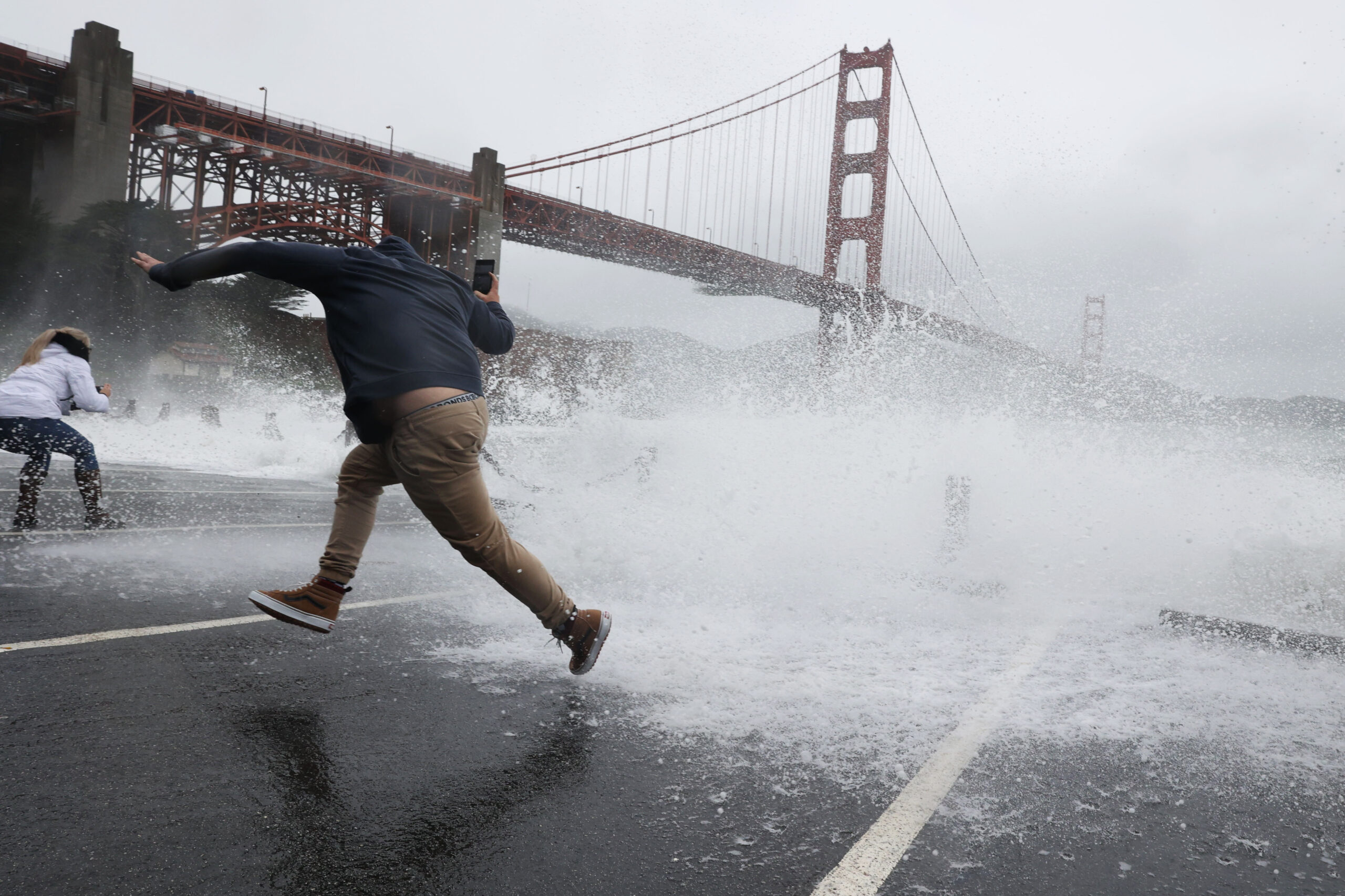
In the first days of 2023, the Bay Area was hit by at least nine “atmospheric rivers,” battering San Francisco with heavy rain and severe flooding. Wind gusts at SF International Airport topped 60 mph in a recent squall, and February’s spate of winter storms brought rare snowfall to low-elevation mountains and hills. Just this week, a tornadic waterspout slithered through Humboldt County’s Shelter Cove.
With all the sideways rain, freezing temperatures and spectacular lightning strikes, some feel this winter is worse than it’s ever been in the Bay Area.
But is it?
Your intuition might be correct—kind of—according to weather data from the National Oceanic and Atmospheric Administration (NOAA). Average precipitation levels and temperatures show that, so far, this winter is not record-breaking, but close.
Rainfall Nearing Record Highs
San Francisco was doused with 5.46 inches of rain on New Year’s Eve, making it the second-highest amount of single-day precipitation in city history. Now, updated precipitation recordings show that Downtown SF’s monthly total precipitation nears previous winter season highs.
With 8.89 inches of rainfall in January 2023, Downtown SF far outpaced the month of January’s average rainfall level of 3.72 inches. In December, city residents waded through 11.60 inches of rainfall, double that of the month’s average of 5.61 inches.
To date, San Francisco has recorded 11.49 inches of total accumulation in 2023, already 72% of the 15.85 total inches recorded in all of 2022.
It’s not just San Francisco, either. This winter is an especially wet one for regions across Northern California.
South Lake Tahoe, which normally sees about 13.18 inches of rainfall between Oct. 1 and Feb. 26, reported a whopping 22.23 inches of rainfall in this winter season to date—that’s 169% of its normal precipitation level. And other parts of Northeastern California, including Reno and Hawthorne, report seasonal precipitation levels that are over 300% higher than the normal average.
Only three Northern California regions—Crescent City, Eureka and Montague/Siskiyou—report season-to-date rainfall levels that are less than the normal range of precipitation for this time period.
It’s Chilly Out There
This February is just a smidge chillier than city averages, too.
Downtown SF’s average temperature in February usually hovers around a comfortable but nippy 54 degrees. But this February, NOAA recorded an average overall temperature of 50.8 degrees Downtown, and the region’s lowest monthly temperature (39 degrees) was three degrees lower than the average minimum.
In what was one of the coldest weeks of this winter season, Downtown San Francisco observed a temperature range on Feb. 22 that hovered between 41 and 48 degrees, significantly lower than the normal temperature range of 48 to 61 degrees.
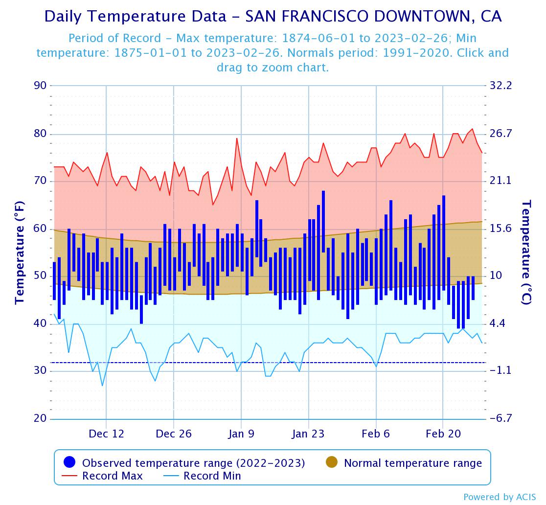
Friday, Feb. 24, was also the coldest that day has been since 1875, dipping down to a minimum of 39 degrees.
TL;DR: It’s not the worst California winter ever—but it’s not far off.