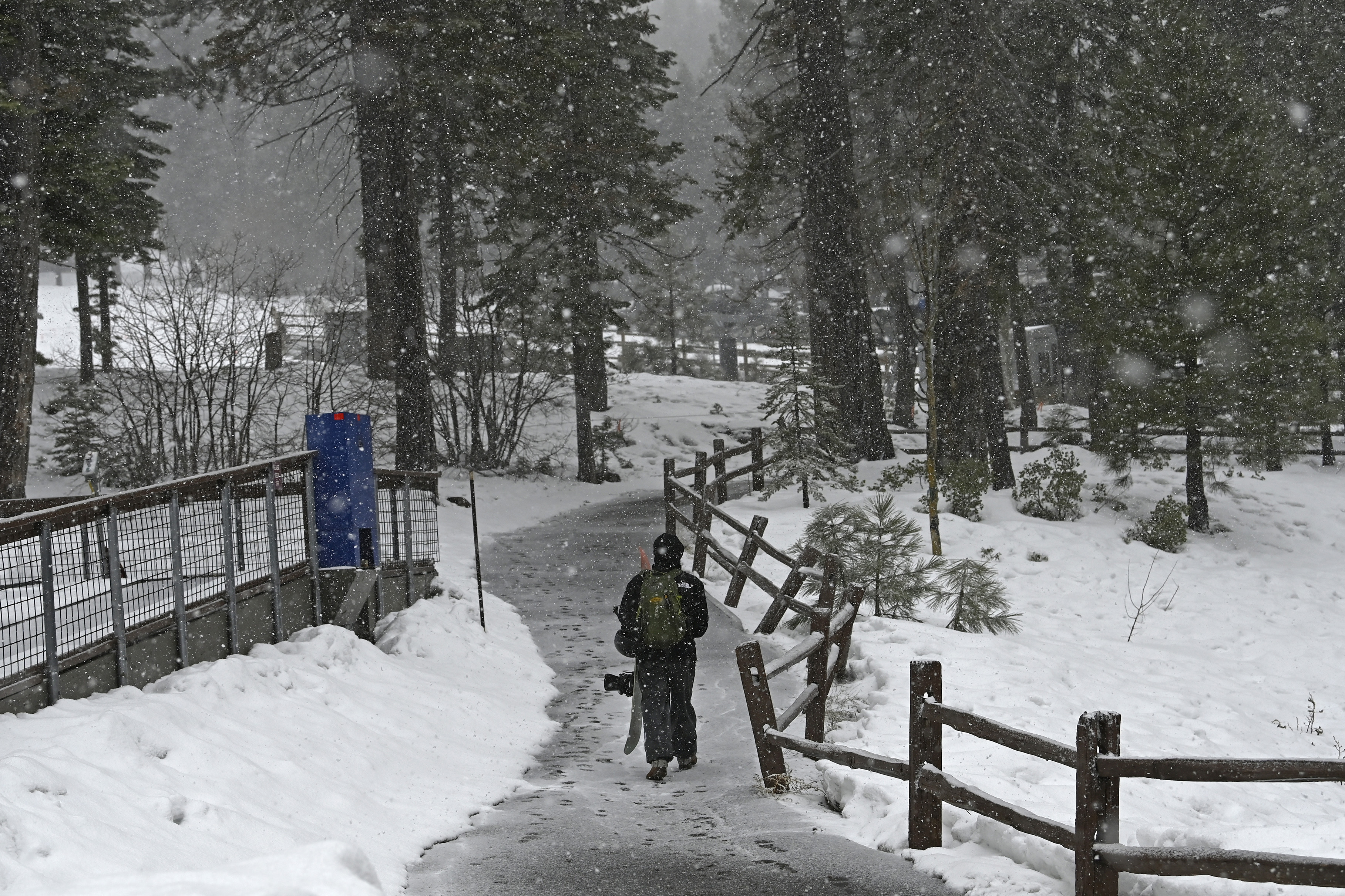
Yosemite National Park will close at midnight, park officials announced Thursday afternoon as a dangerous storm moved into the Sierra Nevada.
The National Park Service said Yosemite will remain closed through at least noon on Sunday, saying that visitors who are currently at the park should leave “as soon as possible.”
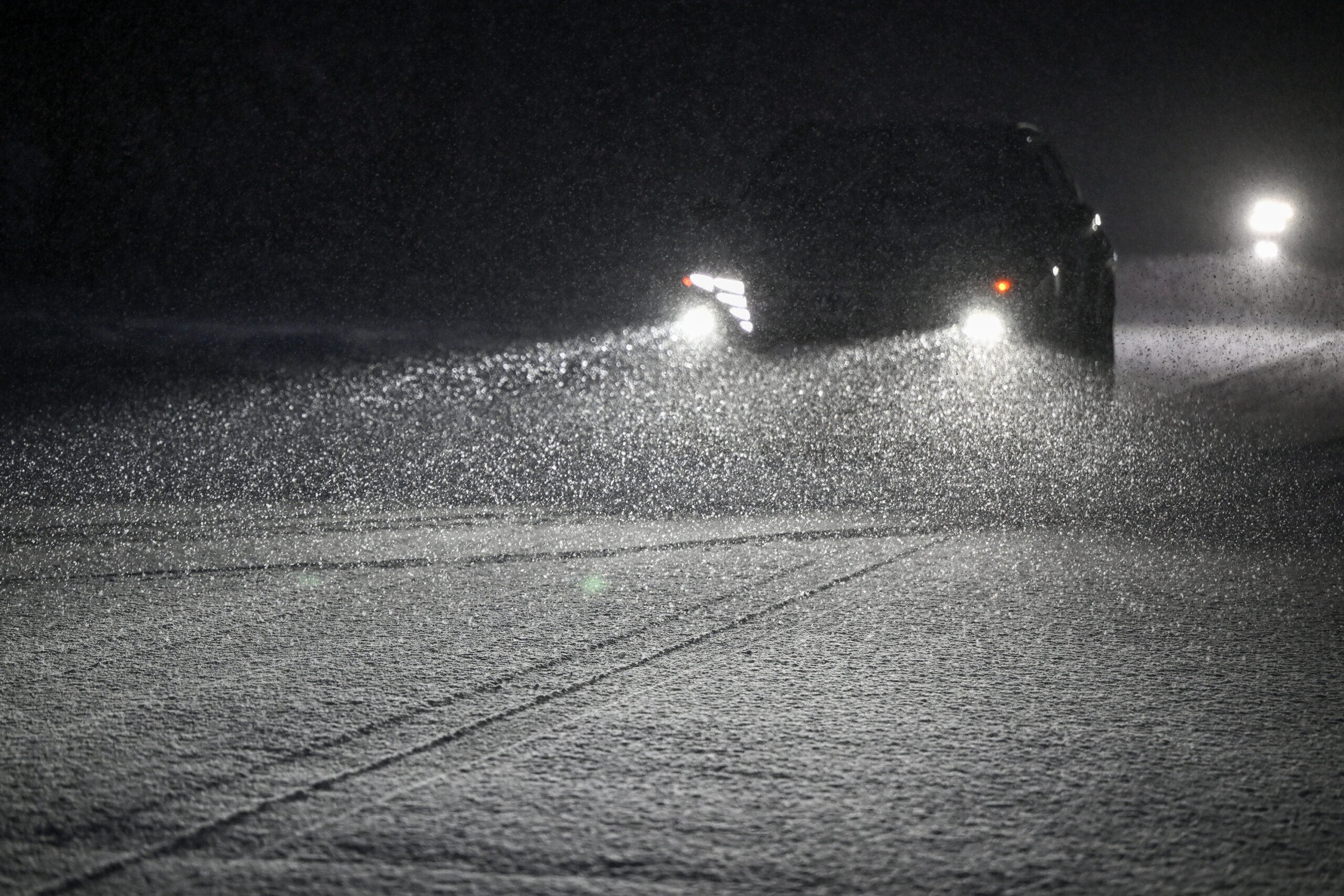
Tahoe travelers have been warned not to take a trip to the mountains this weekend as the massive winter storm bears down on the California mountain range. The National Weather Service said the storm will likely dump 12 feet of snow along parts of Interstates 80 and 50 that are above 5,000 feet in elevation—potentially closing the roads—and blasting peaks with winds up to 135 mph.
The NWS further warned of “extremely dangerous” conditions with the risk of fallen trees and poor visibility, which is expected to dip below a quarter mile during the storm.
“We strongly advise against travel,” Reno NWS Meteorologist Wendell Hohmann said. “It can be life-threatening. Even if you’re prepared, you could get stuck for hours or days.”
Conditions deteriorating on Donner Pass Road, CA with gusts up to 50 mph as the #LeapDayBlizzard moves in. pic.twitter.com/VxfP2LWlF2
— Colin McCarthy (@US_Stormwatch) March 1, 2024
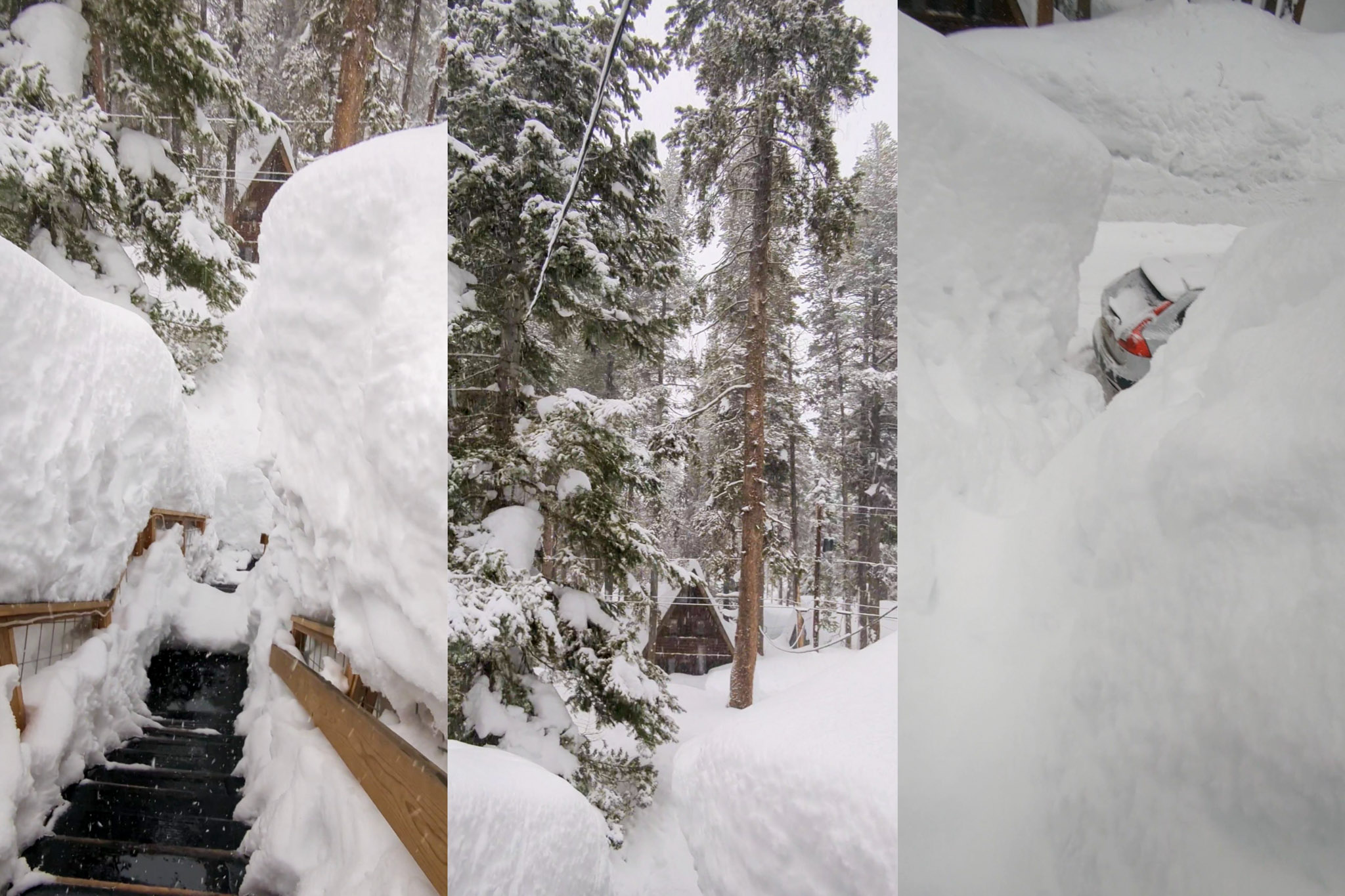
By Wednesday evening, the storm was forecast to be in full swing, with 6 to 12 inches of snow likely, while areas above 7,000 feet were expected to see between 9 to 17 inches.
The Sierra will see fairly light snowfall until around 4 p.m. Thursday, when the storm will start to ramp up, dumping between 14 and 30 inches of snow at lower elevations before Friday evening, while wind speeds will consistently stay between 20 and 35 mph until at least Saturday.
Higher elevations could see even higher snowfall amounts, ranging between 18 and 38 inches before Friday evening. Ridge gusts could reach 115 mph before peaking at 135 mph beginning Friday night and into Saturday afternoon.
The greater Tahoe area will see 3 to 7 inches of snow in the daytime on Thursday, with 3 to 9 inches above 7,000 feet and winds between 20 and 30 mph, with gusts up to 55 mph.
More heavy snow is expected Friday, with 5 to 11 inches of snow expected in the Tahoe area and elevations above 7,000 feet likely to see 6 to 12 inches. The NWS hasn’t forecasted snow totals for the weekend, but heavy snow is expected, with visibility at a quarter mile or less at times on Saturday.
Bay Area weather forecast
While the Sierra will get the brunt of the storm, the Bay Area will see light rain, with San Francisco likely to see anywhere from three-quarters of an inch to 1.75 inches between around 11 a.m. Friday and into Saturday night. Breezy conditions for the city are expected Friday and Saturday, ranging between 11 and 21 mph, peaking at 25 mph Friday night.
The Bay Area is expected to see several inches of rain Thursday through Sunday, according to Monterey NWS Meteorologist Rachel Kennedy.
The North Bay will likely see 1.5 to 3 inches of rain, while the East Bay could get between 1 and 2 inches.
The Oakland Hills will likely see slightly higher rainfall, between 1.5 and 2 inches. and Oakland itself is predicted to get 1.25 inches.
Rainfall totals in the South Bay will range across elevations, with the Santa Clara Valley seeing between 1 and 1.5 inches and the Santa Cruz Mountains seeing between 1.5 and 3 inches.