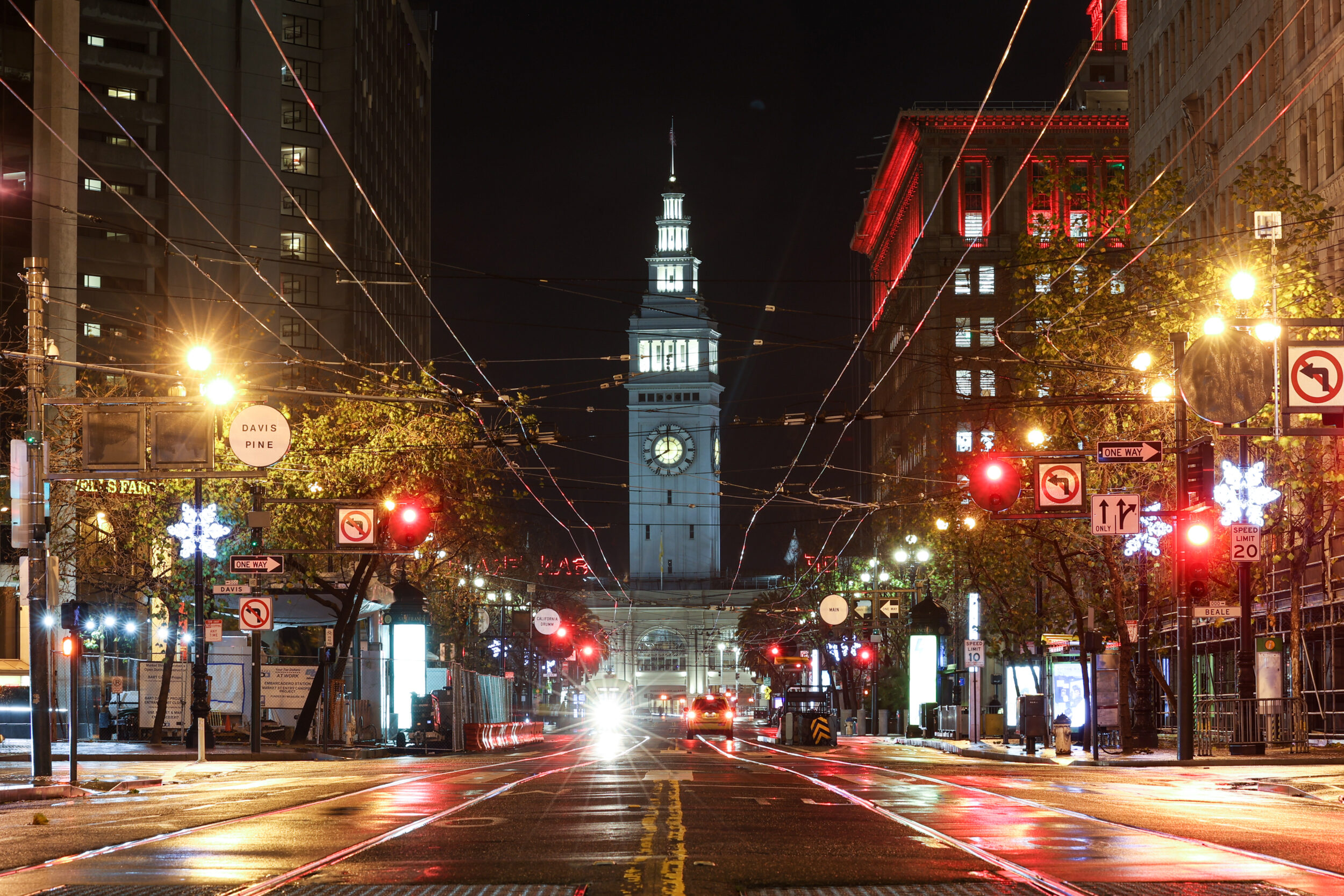
FiDi. Mid-Market. Fisherman’s Wharf. These were some of the answers we received after spending an afternoon around the Ferry Building asking folks to point out where they thought Downtown San Francisco was located on a map.
The question was inspired by a tweet posted earlier this year, which revealed that sometimes even local families can’t come to an agreement about the boundaries of Downtown:
SF people: when you talk about downtown, what are you talking about? Even within my own long time SF family we're all referring to different areas. I'm talking about the financial dist, my daughter Union Square/SOMA across from Union Square, another to the mid/east end of SOMA.
— Lisa Church 🗽 (@lmc) January 2, 2023
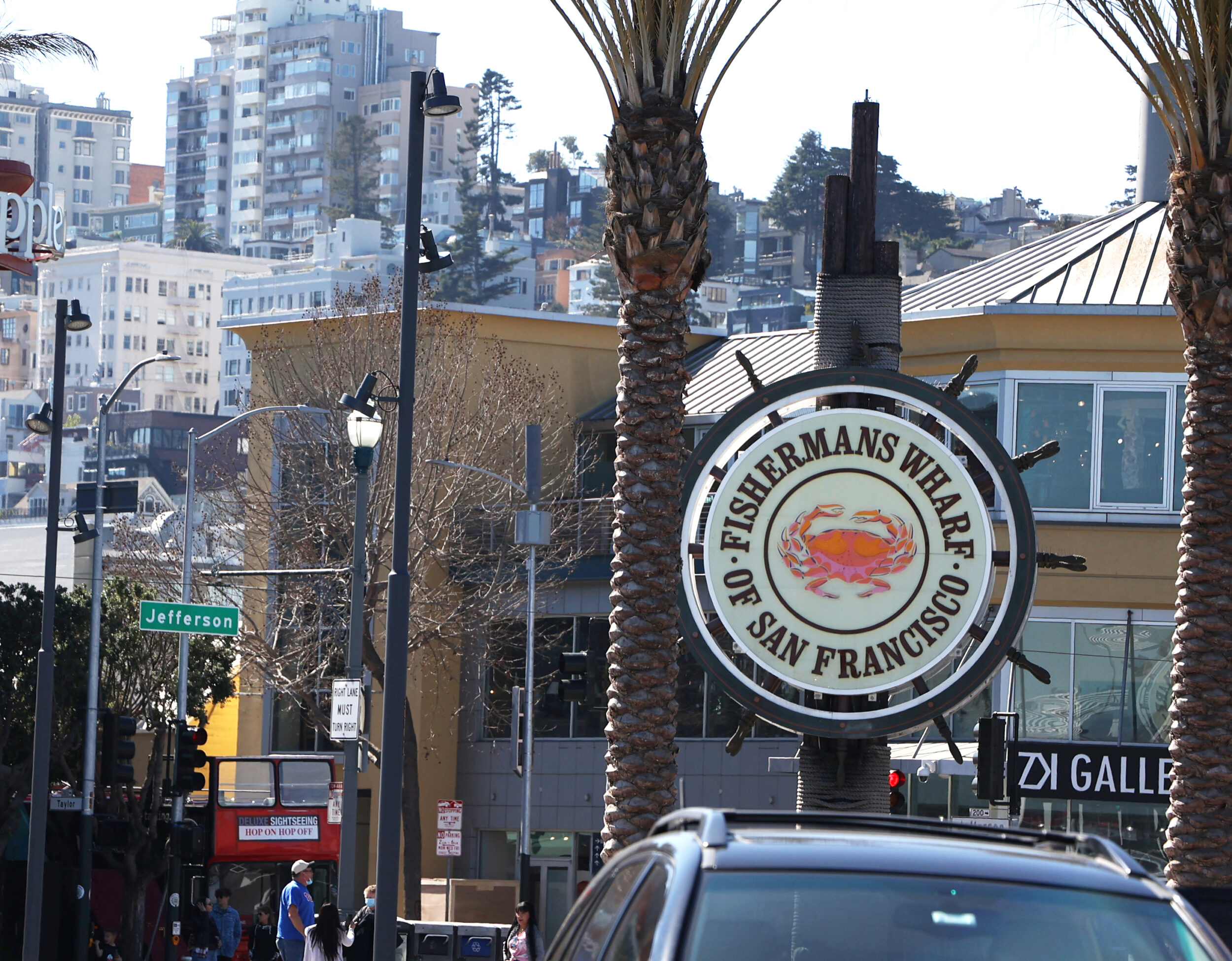
While many of the people we talked with generally agreed that the Financial District could hold the title, the responses we received were quite varied—both geographically and philosophically. Some said Salesforce Tower, located in the so-called “East Cut,” was the definitive beacon of Downtown SF. Others placed emphasis on commercial corridors, like Union Square and Market Street’s “silk road.” Some even included the far-flung tourist trap of Fisherman’s Wharf.
Perhaps this isn’t surprising. After all, even online mapping services seem confused about this question.
Ask Google Maps where Downtown SF is, and it’ll point you to Civic Center. Ask Apple Maps, and it pinpoints the intersection of Taylor and Sutter streets in the middle of what could be considered Lower Nob Hill. And if you still prefer to print out turn-by-turn directions on MapQuest, you’ll discover that Downtown is on Montgomery Street between Bush and Sutter.
Even those who get paid to write about San Francisco for a living gave slightly different answers to the question.
Astrid Kane, a senior editor for The Standard, has lived in SF for 15 years. They identified the Transamerica Pyramid as the northernmost cut-off point of Downtown; the southern boundary, they said, was a bit squishier.
Our business reporter, Kevin Truong, has been writing about the city’s economy since 2016. He tends to think of the Financial District as being synonymous with Downtown—but, he acknowledged, others often lump SoMa, Union Square and Civic Center into their definitions, as well.
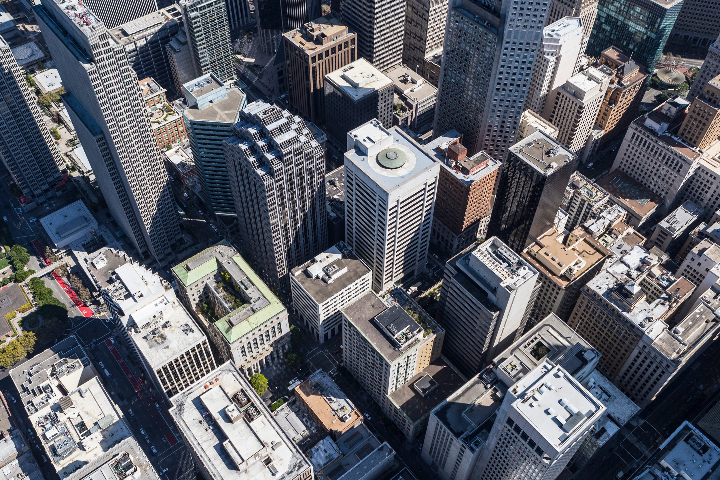
Both Standard staffers agreed that any accurate definition of Downtown would have to include skyscrapers. “It’s basically where the high-rise buildings are,” Truong said.
Who Cares?
The question might seem inconsequential—like little more than a fun theoretical exercise. But knowing what Downtown is and where it’s going is key to the city’s post-pandemic economic recovery.
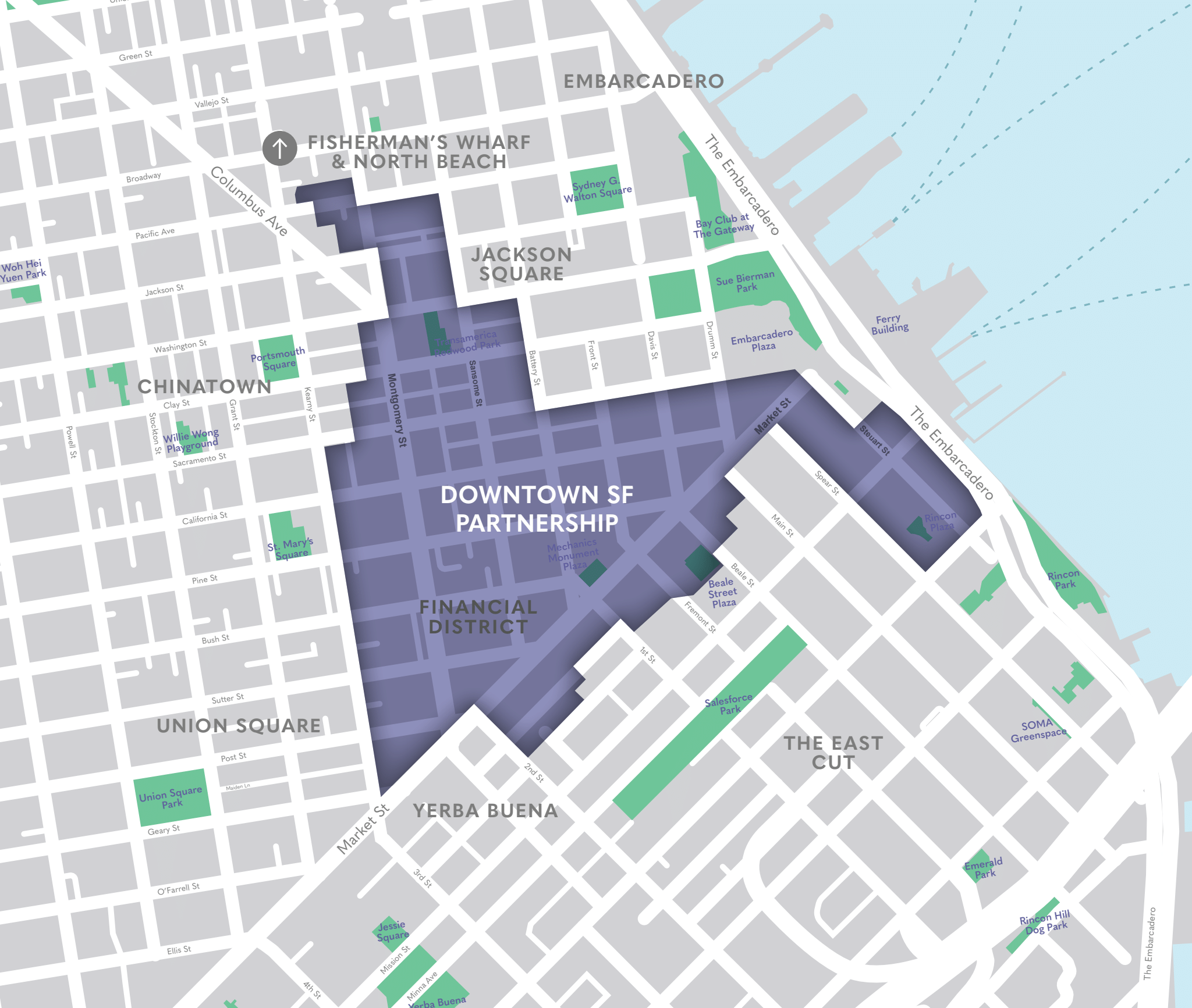
We called up Downtown SF Partnership, the new-ish community benefit district (or CBD for short) for the Financial District and Jackson Square neighborhoods. Although the organization has a map clearly delineating its own the borders, Robbie Silver, executive director of the Downtown SF Partnership, concedes that the precise location of Downtown SF is more confusing.
“We’ve been kind of battling a bit of a perception of, ‘Where is Downtown San Francisco?’” Silver said. “And I think if you ask anybody, you’ll get a different answer any time.”
The 43-block area looks a bit triangular(ish), encompassing the traditional Financial District and Jackson Square, but also dips down into a part of SoMa dubbed the “East Cut” and also juts outs onto a portion of the Embarcadero south of Market toward Howard Street.
While the borders might appear a little “weird,” they were established by consensus, Silver explained. Property owners in the area voted on the boundaries, and in 2020, the Downtown Community Benefit District was established. But that name was a mouthful, so the community benefit district recently rebranded as the Downtown SF Partnership.
The CBD is also in the middle of rolling out a new street signage campaign with 260 banners and 35 big belly trash cans sporting the new Downtown SF moniker and dropping any mention of FiDi or the Financial District. It’s all part of an effort to battle the confusing question of “Where is Downtown SF?” and rebrand the area as more than a 9-to-5 work destination, primarily for white-collar professionals. Moving forward, the organization is planning to center more of its advertising materials on arts-focused events and activations, like Let’s Glow SF, to draw more people Downtown after business hours.
But the rebrand is about more than just marketing. It could be essential to the city’s economic recovery. Due to the rise of remote work and high office vacancy rates as a result of the pandemic, San Francisco could lose as much as $200 million annually, according to the city’s chief economist.
“We may not want to go back to the normal 9-to-5 because that limits the type of economy that Downtown SF can have,” Silver said. “When we activate a Downtown beyond 5 o’clock into the evening hours with hospitality, with arts and culture, it can bring a much more diverse audience to Downtown that never interacted with Downtown before.”
The Official Line
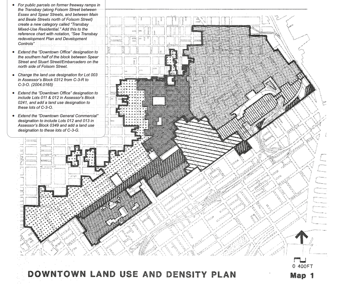
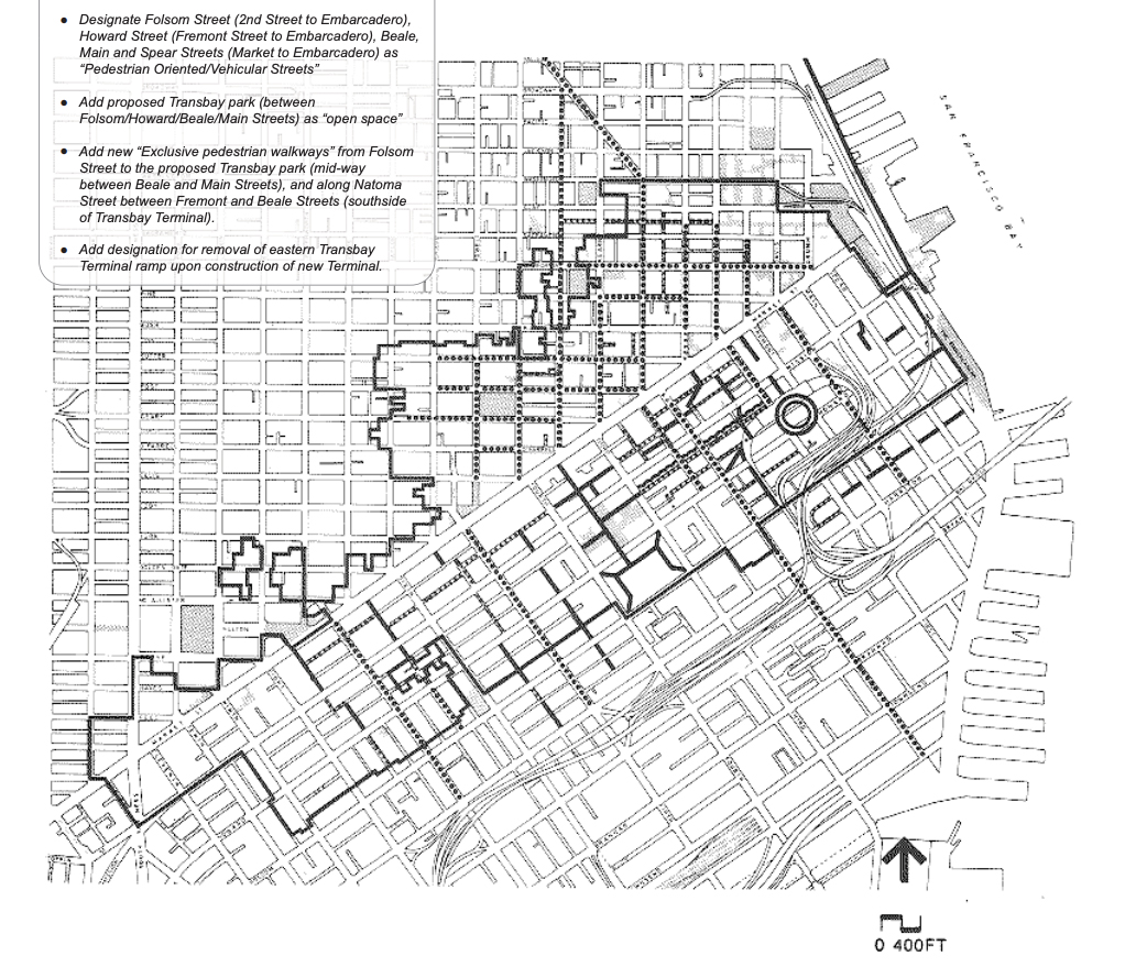
We reached out to the Mayor’s Office and Office of Economic and Workforce Development, and they directed us to two maps of the Planning Department’s Downtown Area Plan as the boundaries of Downtown.
That’s how we ended up talking with Dan Sider, the Planning Department’s chief of staff. He offered us some technical and philosophical answers.
“For zoning or for land use, Downtown is a C-3 district,” Sider explained. According to the planning code, C-3 districts are labeled as “Downtown Commercial” and can encompass everything from offices and retail to hotels, clubs and entertainment venues. “The C-3 zoning is categorically north of Duboce and Division and east of Franklin and south of Washington.”
But Sider also directed us to this map which identifies the neighborhood boundaries that the Planning Department uses for notification purposes. Notably, the term “Downtown” is tacked onto to Civic Center with a slash, and FiDi and South of Market are listed as separate neighborhoods.
It’s confusing to be sure, but ultimately drawing neighborhood boundaries is more “art than science,” Sider observed. The idea of a “downtown” can also be “highly subjective,” he noted.
“You can look at a map, and we can point exactly to where those [C-3] Districts are and where the line for those districts are drawn. It’s a fairly straightforward binary undertaking,” Sider said. “If you are stopped by a tourist in Hayes Valley and then [they] say, ‘Hey, how do we get to Downtown,’ or ‘What’s the best thing to do Downtown?’ that can be a very different answer.”
Ultimately, Sider stated that “while we needed to put lines on a map in order to comply with the Planning Code’s notification requirements, we have no intention of trying to regulate the minefield of neighborhood nomenclature and borders.”
In other words, where Downtown is and what it might become is up to us.